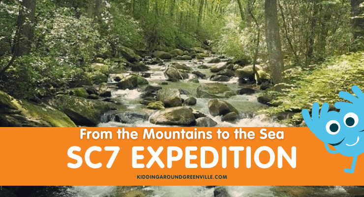
The SC7 Expedition is once again exploring the state from the mountains to the sea, this year in April and May 2024! The name South Carolina 7 represents seven natural wonders in our state, including National Geographic-recognized ecological areas and historical sites such as the Jocassee Gorges, Sassafras Mountain, and the Chattooga River.
Kidding Around covered this epic month-long event in 2021; you can find everything about that year’s route in our article South Carolina’s Top 30 Beautiful Natural Spots! This year the team is following a similar path across the state, with a few new locations – including several in the Upstate.
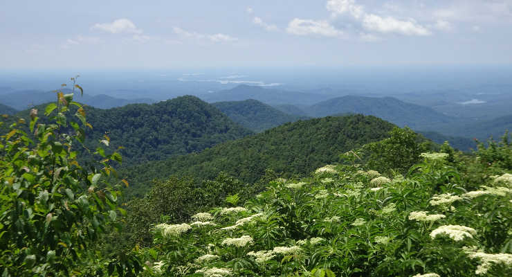
Waterfalls, wilderness areas, wildflowers and epic views… No, we’re not talking about a national park somewhere out west, but our very own Foothills Trail! Backpacker magazine rated it as “one of the best long trails (fifty-plus miles) in the country,” and it traverses the Jocassee Gorges, which National Geographic named one of “50 of the World’s Last Great Places—Destinations of a Lifetime”… this isn’t just any walk in the park! Well-suited for a through-hike for families looking for a challenge, yet accessible even for the shortest day-trip ramble, the Foothills Trail is rapidly gaining notoriety as one of the premier trails in the southeast.
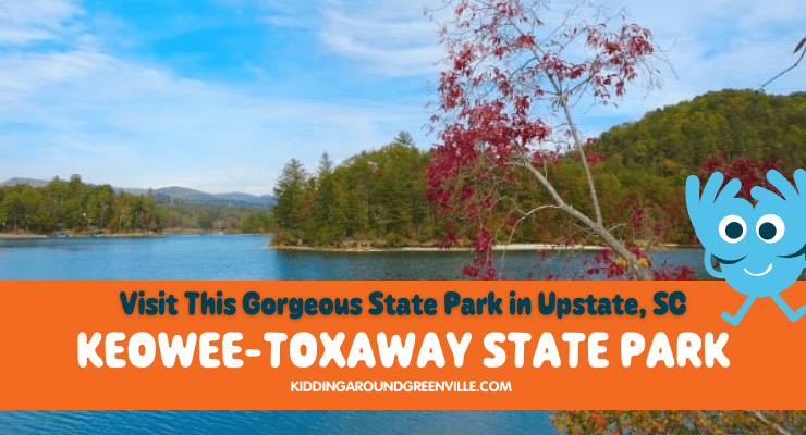
Keowee-Toxaway State Park straddles Cherokee Foothills Scenic Highway (Hwy. 11) between Devils Fork State Park and Long Shoals Wayside Park, one of eight South Carolina State Parks located along the edge of the Blue Ridge Escarpment.
Known for spectacular views of the Blue Ridge Mountains, the 1,000 acre park is considered a gateway to the Jocassee Gorges, the area defined by a series of steep-sided gorges delivering mountain rivers and streams down to the Piedmont of South Carolina.
Things to do at Keowee-Toxaway State Park
Have a picnic
The state park is split by Highway 11, with the picnic shelters located on a short loop to the south. Five picnic shelters are available for rental. The picnic tables with free-standing grills throughout the park are offered on a first come, first serve basis.
Stop at the Visitor Center
Once you’ve finished your picnic lunch, head across Highway 11 to the north portion of the park. The Park Visitor Center houses exhibits about the natural diversity and history of the park, and its importance as a scientific research destination of the region.
If you’re looking to check out the Visitor Center, be advised that office hours are 11 am to noon and 4 – 5 pm. Despite these rather short hours, the Park is open Saturdays through Thursdays from 9 am – 6 pm and Fridays 9 am – 8 pm. After daylight savings time, the park is open Monday- Sunday until 9 pm. Keowee-Toxaway State Park is free to the public.
Hiking & Creek Stomping at Keowee-Toxaway
There are 5.5 miles of trails in the Park, the two main hikes being Raven Rock Trail and Natural Bridge Trail. The trailhead for these two trails is located behind the park office. Natural Bridge Nature Trail is a 1½-mile loop, and at the far end of the loop is the Raven Rock trailhead. Combined with the Natural Bridge loop, you achieve a 4.4-mile hike to Raven Rock and back.
Use the Keowee-Toxaway SP trail map to help you navigate the area easily.
Natural Bridge Trail
Hiking the Natural Bridge loop clockwise starts you off along Poe creek and numerous small waterfalls. Soon you’ll come to the intersection with Raven Rock Trail with its views of Lake Keowee, passing rock outcrops and a boulder field before reaching Raven Rock. Looping back to Natural Bridge Trail you’ll cross Poe Creek on the trail’s namesake, an enormous natural rock ‘bridge’. You’ll then cross through an upland hardwoods forest to reach the parking lot.
Lake Trail
The ½ mile Lake Trail departs from the campground and emerges from the woods near the Villa to Lake Keowee, where guests can enjoy fishing for bass, bream, crappie, and catfish.
Keowee-Toxaway is a perfect hike for a spring day! Keep your eyes peeled for the wildflowers that enjoy the moisture along Poe Creek. You’ll also enjoy the rhododendrons and azaleas blooming in late spring and early summer. On a hot summer’s day prepare to cool down in Poe Creek. The irresistible tumble of water makes it hard to leave. Autumn brings colorful fall foliage, but catching the right day in winter means less-crowded trails and parking lots – this is a park for all four seasons.
Camping at Lake Keowee
Ten paved camping sites have individual water and electrical hookups for RVs up to 40 feet, while the tent camping area has 14 sites with central water, individual tent pads and fire rings. Restroom facilities with hot showers are available, as well as a dump station.
Backcountry camping is allowed at three designated sites on Lake Keowee. These are accessible by a hike on Raven Rock Trail, or by paddling to them in a canoe/kayak. For larger groups a primitive group area is located in the backcountry; registration is required and reservations are accepted.
If camping isn’t for you, reserve the three-bedroom villa that overlooks Lake Keowee near the boat launch. The cabin is completely furnished, heated & air-conditioned with all the amenities. It comes with linens, cooking and eating utensils, washer/dryer, satellite television, Wi-Fi, two fireplaces, and a private boat dock. Just know that pets are not allowed in the cabins.
Enjoy Lake Keowee!
Boating: Keowee-Toxaway provides non-motorized boat access to Lake Keowee; to launch a motorized boat you have to use the access at Fall Creek Landing, five miles southwest of the park.
Fishing: Fishing is allowed. Bass, bream, crappie, and catfish are commonly caught fish.
Swimming: Swimming is allowed, however, there are no lifeguards or designated swimming areas in the park; swim at your own risk.
With easy access to Lake Keowee, three beautiful trails with all kinds of unique natural features, and spectacular views throughout the park, Keowee-Toxaway has plenty to offer. We’ve enjoyed our visits in all four seasons. However, spring has a special magic with the ephemeral wildflowers blooming and trees budding electric green. Head north to this gem of a state park and experience the magic for yourself!
A portion of this post originally appeared on Femme au Foyer.
What’s your family’s favorite thing to do at Lake Keowee?
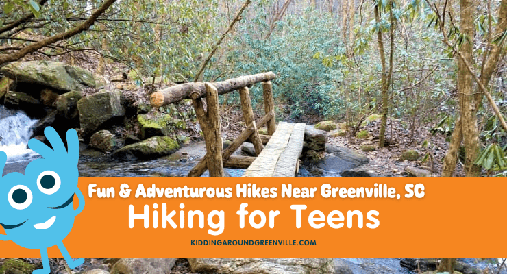
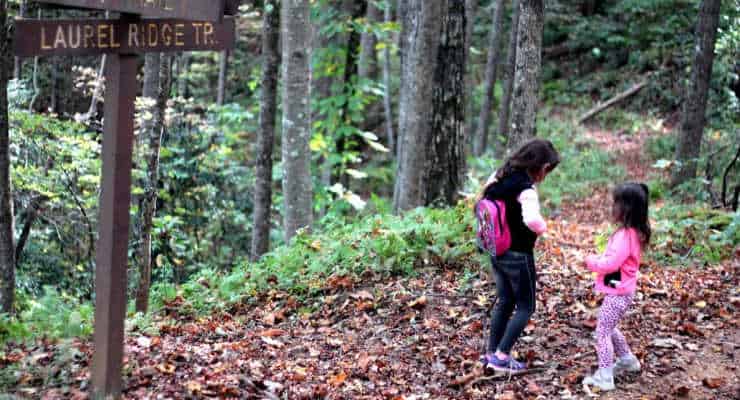
Are you looking for fun or adventurous hiking for teens in Greenville, SC? Here’s our list of great hikes for teens in or near Upstate, SC! Some are challenging and some a bit more relaxed, perfect for a day with friends or family. Plus, there are plenty of trails with gorgeous views that are perfect for the ‘gram. For even more hiking ideas see our list of our favorite local hiking trails.
There are so many great hiking trails in the Greenville area or nearby, it’s truly hard to choose where to go. Luckily, the weather here can lend itself to hiking all year round for the most part, which means lots of weekends to take the teens out on adventures.
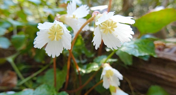
Have you seen the Oconee Bell? Spring is the perfect time to spot this rare flower. It doesn’t bloom in very many places, but Devils Fork State Park is one of the few places you can see the Oconee Bell.
The sides of the streambed are blanketed in waxy, red-tinged leaves, small white flowers visible only upon a closer look. Had we not traveled to Devils Fork State Park specifically to see this delicate wildflower, we might have hiked right past the colonies of this rare plant.
About the Oconee Bell
The Oconee Bell is only found in a few locations in the southern Appalachian Mountains, in moist, wooded areas along the streams of Georgia, North, and South Carolina, like Jocassee Gorges. The tiny flowers are one of the first to bloom in the Upstate, and attract quite the crowd to this state park better known for summer swimming and camping.
One of the rangers said “We had a brochure in the holder by the trailhead. Usually, folks finish the trail and put them right back. Last weekend cleaned us right out, there were at least a hundred; I’m going to have to print more.” (This was on our visit last year, right about the middle of the month of March.)
The flower has a very limited range in the wild, and so the appearance of the native wildflower is cause for celebration. Every year Devils Fork SP puts on the Oconee Bell Nature Walk. If you can’t make the ranger-guided walk, you can still see the Oconee Bell blooming; the flower usually blooms from mid-March to early April, and the Oconee Bell Nature Trail takes you along a dozen colonies of this unique wildflower. The park holds Bell Fest every year as well, a festival dedicated to the rare wildflower that also has lots of great local vendors. In 2024, the date is Saturday, March 16th from 10 am – 3 pm. It’s free with park entry.
The Oconee Bell Nature Trail
The trail is an easy 1.5-mile loop that takes hikers through the oak-hickory forest, past a small pond full of American toads, and alongside the creek that is home to the elusive wildflower that gives the trail its name. In addition to the Oconee Bell, dozens of other plants and trees are identified by wooden markers, and several small cascades on the creek add to the list of attractions available year-long.
If you’re headed to Devils Fork to hike the Oconee Bell trail you just follow signs to the Ranger Station. A quick stop there for a map or restrooms, and then it’s just a matter of crossing to the other side of the parking lot to the trailhead. The parking lot is on the southeast corner of Lake Jocassee, and the scenic views of the lake, Double Springs Island, and the swimming and picnic area on the southwest shore are stunning.
Bring a picnic to eat on the lake, or upon finishing your hike circle around to Buckeye Drive where you will find picnic shelters and a playground.
In any case, make sure you practice what the Park Naturalist terms “belly botany” – to get an up-close look at the low-lying flowers you’ll have to get close to the ground. There are several locations where the colonies are right on the trail, so it’s relatively easy for all the kids (and adults) in your group to get a good look at the Bell. Remember, for your safety and the protection of the bells, please stay on the trail!
Your next family adventure should be Stumphouse Tunnel in Oconee County, SC! Local Mom Deidre and her family visited the tunnel and Issaqueena Falls near Walhalla, SC. Only about an hour and a half from Greenville, this day trip is so worth the trip. We will give you all the information you need to plan a trip to Stumphouse Tunnel with your family.
If you’re out hiking with kids anywhere in the Upstate, SC – or anywhere actually – we’ve got a list of 10 things you may want to consider carrying with you.
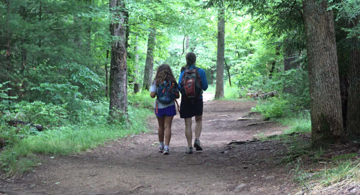
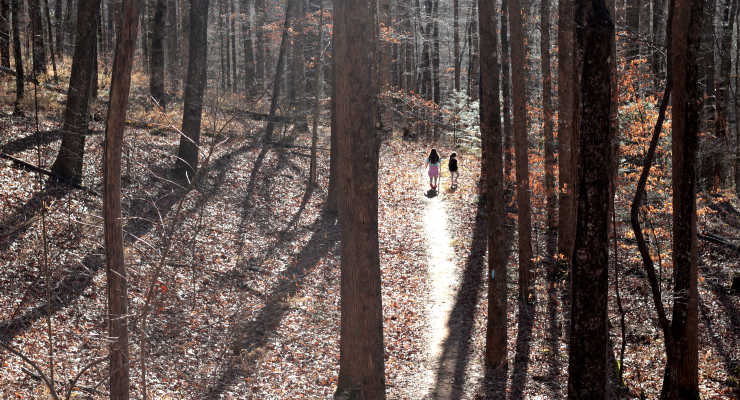
Our area boasts hundreds of miles of trails, from an easy stroll to strenuous trails up mountaintops. Lots of these trails are perfect for kids! I’ve come to enjoy hiking with my family, rarely hitting the same trails twice because there are just so many to choose from.
I’ve been hiking with my youngest from the time she was just three months old and strapped to me in a baby carrier (she’s eight now) and time in nature is something that has become almost a weekly ritual for us. There has been a lot I’ve had to learn, including what to carry with me when we hike.
Nature Equals Adventure
I wasn’t always so interested in hiking with my kids though. Hiking with kids is an adventure in itself. I started hiking just a handful of times a year with my two kids. I then added more and more hikes every year, learning something new every time.
Now it’s an adventure I take with my two kids that we all enjoy and love. Remember to start with easy trails. Be careful not to overestimate your – and your kids’ – abilities and get in a situation that you aren’t prepared for. Older kids can typically handle more challenging hikes, plus they can help carry more items!
But what do you bring with you? That’s what I’m going to cover here. Most seasoned hikers will tell you to bring the “Ten Essentials” – wise advice, whether its a local trail or national park. These essentials vary a bit and I’ll add some to this list but will also incorporate what I’ve learned in my years of hiking experience as well.
If you’re thinking of getting started hiking find more tips for hiking in our Newbie Guide to Hiking, which you may want to take a look at first.
10 Things to Take With You When Hiking with Kids for a Successful Hike
#1 Water
Don’t forget the water, especially in the summer. Getting dehydrated should not be on your to-do list. Make sure all the tops of the water bottles are closed tight and aren’t leaking into your backpack (I’ve learned the hard way on this one). There are also kid-friendly backpack style water bottles like this one. In cases of emergency, I also carry a LifeStraw, a straw with a personal water filter you can use and drink safely from streams or other water sources.
#2 Snacks
Snacks on hikes are vital. They almost made it to the top spot in this list. Kids are whining? Give them a snack. Kids complaining they are tired? Give them a snack. You want your kids to make it to the waterfall? Bribe them with a snack. Kids love a good snack after a long hike!
#3 First Aid Kit
I always have carried band-aids with me but have since added more to my little portable First Aid Kit – namely antibacterial wipes, hand sanitizer, Neosporin, and After Bite to deal with stings (this is the product I’ve used the most).
#4 Sunscreen
We do a lot of hiking and swimming in the summer and carrying extra sunscreen is important.
#5 Map
I always screenshot a map of the trail I’m planning to hike on my phone and then take a photo of the map, if available, at the trailhead, if I don’t have a hard copy. This is especially key in more remote places that are less traveled. I used the AllTrails app but love Gaia as it’s usually more accurate. Maybe even plan out a scavenger hunt along the trail for fun!
#6 Trash bag
I always carry a plastic grocery bag we use for trash, both ours and the trash we find on the trail. Pack out what you pack in – a big part of the Leave No Trace principles. If you have a kid in diapers, take those diapers out of the forest with you and dispose in a trash can. Same with dog waste – it’s not ok to leave waste on trails or in trash bags on trails.
#7 Flashlight or headlamp
I’ve never had to use this on a hike but always carry it just in case. In our area, it’s not uncommon to read local news stories about people getting lost in the woods, especially over the summer since more people are out on the trails then.
#8 Pepper spray or some kind of protection
I’ve never had to use this but after an alarming number of loose dog encounters, I now carry both pepper spray and a small, handheld zapper. A lot of people like to carry bear spray in the off chance of an encounter with aggressive wildlife.
#9 Rain poncho
Getting caught in the rain, especially if it’s cold or when a chance storm hits, isn’t fun. Keeping kids protected with lightweight rain gear is a good idea.
#10 Firestarter
Bring matches and something to use for tinder (dryer lint works great) in case you need it.
Some other suggestions that may be helpful are a knife, a plastic tarp you could use as a makeshift shelter, and extra socks. If you’ve got a baby with you, be sure to bring extra diapers and wipes.
Ready for a FREE adventure? Head to the summit of South Carolina’s Sassafras Mountain where an observation tower awaits. From the tower, you’ll be able to see across the mountains of North Carolina, Georgia, and even into Tennessee. local mom, Liene, has all the details so you can plan this fun, FREE, adventure with your family!
Sassafras Mountain: elevation 3,553’. It’s the highest point in the state of South Carolina and a spot to keep in mind as you’re planning summer adventures! The peak straddles not only the line between North and South Carolina but the Eastern Continental Divide; from its summit, four states are visible on a clear day. Still, this scenic viewpoint is one of the most easily accessed “highest points” in the US, perfect for a family day trip from Greenville.
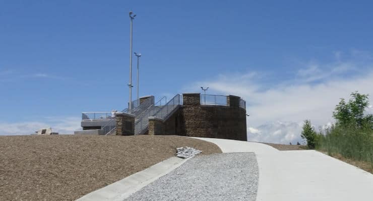
Sassafras Mountain’s Observation Tower
It wasn’t always accessible. Although long the site of a fire lookout tower, it was only in the 1990s that the SC DNR acquired the acreage of what is now known as the Jocassee Gorges. At that time the last 4.5 miles of road to the summit were paved, a parking lot was installed, and in 2010, three acres of trees were cleared from the summit, revealing the views that can be seen today.
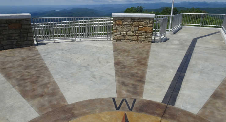
The breakthrough came when the viewing plaza at the top of Sassafras Mountain was completed, including picnic tables, several viewing platforms, a central viewing tower, multiple trails, educational signage, and restrooms. The observation tower is also ADA accessible!
Where is Sassafras Mountain?
Sassafras Mountain is just a short detour off scenic Highway 11 in Pickens County, the mountain road that travels along the base of the Blue Ridge Escarpment. It offers nice vies of the Blue Ridge Mountains as well. From Pickens, it’s 16 miles north on US 178 to Rocky Bottom, where after making a right turn (east) on F. Van Clayton Memorial Highway it’s about 5 miles to the end of the road (just short of the summit).
Plenty of parking, as well as convenient restrooms, make it an easy spot to explore with kids, and temperatures tend to be about 10˚ cooler than in Greenville, convenient on a hot summer day.
1391 F Van Clayton Memorial Hwy, Sunset, SC 29685
Hiking Trails Near Sassafras Mountain
While you can drive to the top of Sassafras Mountain and head to the observation deck without any hiking, what if you want to do some hiking? There are trailheads at the top of Sassafras Mountain where you can access the Foothills Trail. You can hike all the way to Table Rock if you desire, but it’s strenuous and not a hike for families.
You could just walk a short portion of the trail and turn around to climb back up to the observation platform for lunch with a view. Or you could just meander around the observation area and boulders to enjoy the views. But if you really want to do some hiking as a family, there are several great trails for families near Sassafras.
Twin Falls is an easy hike with a big payoff. It’s about 25 minutes away from Sassafras Mountain. Table Rock State Park is 27 minutes away and it has several trails to choose from. Carrick Creek Trail is great for kids. Devils Fork State Park/Lake Jocassee is 40 minutes from Sassafras. The mile-long Oconee Bell Trail there is beautiful, especially in the spring. The lake is fantastic for paddling and swimming. Mile Creek Park is 40 minutes away and is great for swimming. Brevard, NC is 30 minutes away and it has tons of waterfalls and trails.
Sassafras Mountain Things to Do
The views from the summit stretch to the Highlands in North Carolina, Mount Pisgah on the Blue Ridge Parkway, the Chattooga Ridge near Walhalla, and to Georgia & (supposedly) Tennessee (I say supposedly because although it was easy to pick out the Georgia range, I wasn’t sure if it was the Smoky Mountains in TN we were looking at in the distance). Pack a picnic, bring binoculars, and don’t forget your camera!
About Sassafras Mountain: 3 Interesting Facts to Share With the Kids
3 Watersheds
Interesting fact, this is the separation point for three distinct watersheds: two into the Atlantic and one into the Gulf. Water draining from the east side of the mountain flows into the South Saluda, then on to the Broad River, the Congaree and then into the Santee-Cooper Lakes, ending up in the Atlantic.
From the south side of the mountain, water drains into Eastatoe Creek, running through Lake Keowee and Lake Hartwell down to the Savannah River and also into the Atlantic.
Water from the north and west sides of the mountain flows into the French Broad, making its way north through Asheville and Knoxville into the Tennessee River, then the Ohio River, and finally the Mississippi (up to Cairo, IL!) before flowing back down south into the Gulf of Mexico.
2 States: North and South Carolina State Line
Although Sassafras is the tallest mountain in the state, a portion of it is actually in North Carolina. While there, check out the markers for the state line, just a short distance west on a rock outcrop. Two states for the price of one… and that price is $0, as there is no admission to the park.
1 Highest Peak in South Carolina
In a list of each state’s highest peak, Sassafras Summit ranks 29th. Neighboring North Carolina’s Mount Mitchell comes in 16th at 6,684’, and Georgia’s Brasstown Bald 25th at 4,784’. Although nearby Tennessee also has a higher peak (Clingmans Dome, 17th at 6,643’), at least we’ve got Florida beat – at 345’ Britton Hill comes in dead last, even after the District of Columbia.
However, this lower ranking shouldn’t stop you from making the 60-minute drive from Greenville this summer. The drive is scenic, the views are unbeatable, and the fresh mountain air will inspire and invigorate you to climb more peaks!
Does your family love to go hiking? If you are looking for winter hikes near Greenville, SC, you’ve come to the right spot! Here’s where to go hiking around Greenville this winter and what to bring.
Taking your kiddos on a hike in winter may seem like a crazy feat, but if the unpredictable upstate weather is in your favor it can be one of the best times to go. Cooler temperatures bring broader views, a change of scenery, less sweat, and fewer bugs. It makes hiking the tougher trails just a bit easier and also allows you to choose hikes that offer a view, rather than a water feature, as a payoff – something you wouldn’t opt for in the summer months. Get your camera ready and read on for a list of tips to help you and your little troops make the most of your adventure.
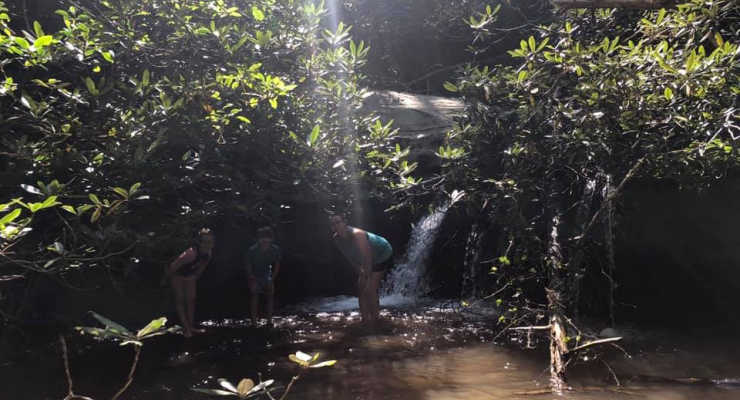
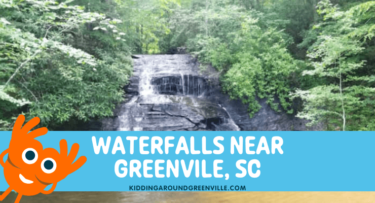
Are you wondering where to go to find some beautiful waterfalls without traveling too far from Greenville, SC? You’re in luck because we have gathered all the information you need about finding waterfalls close to home, all in one handy place! Whether you want to take in a waterfall while enjoying a long hike or a waterfall that you can view with very little effort, local mom Kristina has all the details right here!
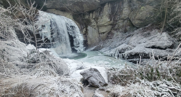
Waterfalls can be quite magical and we have so, so many near us in the Upstate. Waterfalls are beautiful any time of year also – surrounded by wildflowers in the spring, framed by greenery over the summer and perfect for swimming, delivering fall colors in autumn, and showing off (some) frozen beauty in winter.
It is incredibly important for your own safety and for the safety of your family, EMTs, and rescuers, to never play at the top or sides of a waterfall, even for a second or to get an Insta-worthy photo. Those rocks are slippery and many people have unfortunately lost their lives at waterfalls in our area.
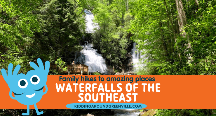
Below are some of our favorite waterfalls near the Upstate, SC. But, if you love waterfalls you’ll want to take a look at this list ofWaterfalls of the Southeast, loaded with waterfall hikes in South Carolina, North Carolina, Georgia and Tennessee.
Waterfalls in & near Greenville, SC
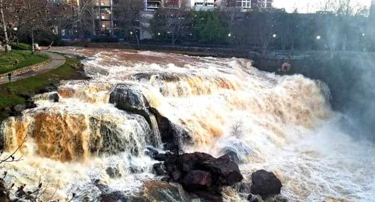
Falls Park
You don’t have to go far to see the first waterfalls on this list. Pack a picnic, relax on the nearby swings, or take a walk through Falls Park on the Reedy River in downtown Greenville and see the beautiful waterfalls that run right through our beautiful city.
South Main Street and Camperdown Way Greenville, SC Distance from Greenville: 0 minutes – it is located downtown
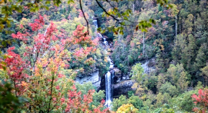
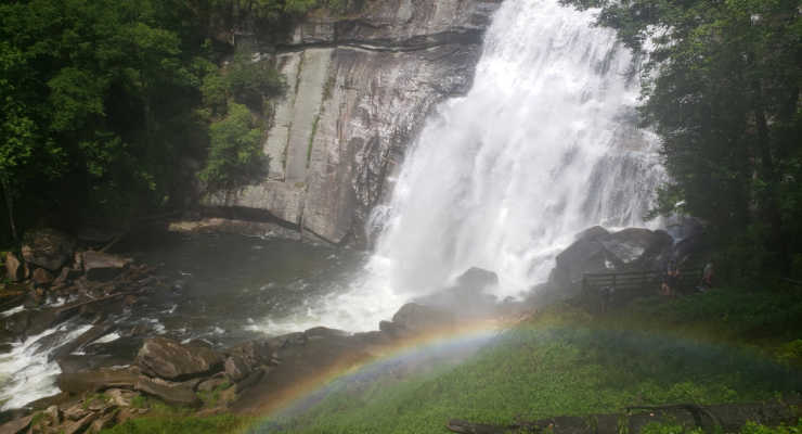
Raven Cliff Falls
Take the two-mile long Raven Cliff Falls trail to view the gorgeous 420-ft Raven Cliff Falls from an overlook at Caesar’s Head State Park. There are also a variety of hiking trails within that park and the surrounding Mountain Bridge Wilderness.
Or if you’re a more experienced hiker, take the Dismal Trail to get to the suspension bridge that goes over the falls. It’s a tough 8+ mile loop but worth it.
8155 Geer Hwy Cleveland, SC Distance from Greenville: ~hour
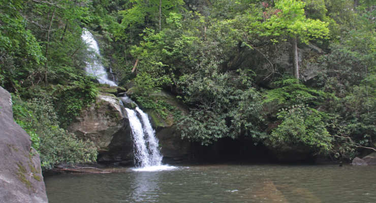
Jones Gap State Park
Known for its natural scenery, this 300 acre park is perfect for a relaxing day of exploration – and waterfall viewing of course. One of the more popular trails leads uphill to the stunning Rainbow Falls. It’s a strenuous trail but there are other waterfalls that are along the main trail.
This is a hugely popular park that now requires reserved parking ($5) on weekends in addition to the entrance fee.
303 Jones Gap Road Marietta, SC Distance from Greenville: ~an hour
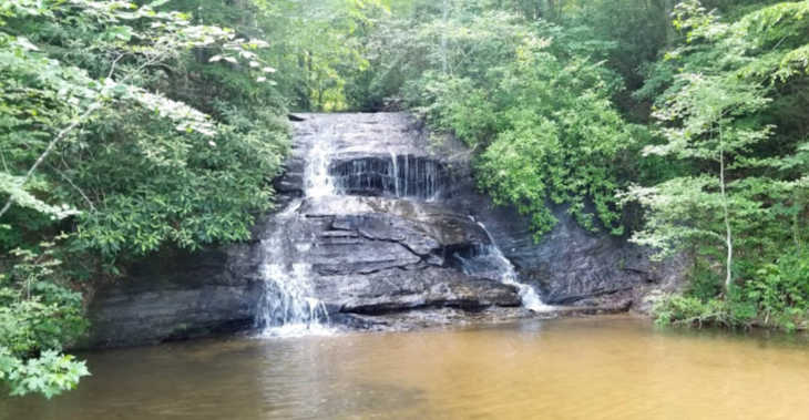
Station Cove Falls
This waterfall in Oconee County near Hwy 11 is so, so stunning. It’s a big waterfall towering high dripping water from hundreds of small ledges. It’s also a very easy hike, about 1.5 miles round trip.
State Rd S-37-95 Walhalla, SC Distance from Greenville: an hour and 10 minutes
Station Cove Falls
Chau Ram County Park
A little over an hour from Greenville, Chau Ram Park is called South Carolina’s “Best Kept Secret” by the Oconee County Recreation and Tourism Department. There is a 40 foot waterfall at Ramsey Creek plus the county’s longest suspension bridge here. You can also swim, hike and camp, all for only $2 per car load.
1220 Chau Ram Park Road Westminster, SC Distance from Greenville: an hour + 5 minutes
Table Rock State Park
Table Rock contains lots of awesome waterfalls easily accessible from the many trails that wind through this beautiful park. Trails are not stroller-friendly so be sure to either bring a baby carrier if you’ve got a little one or sturdy shoes for the younger kids. There is a fee to enter the park if you don’t have a park pass.
158 Ellison Lane Pickens, SC Distance from Greenville: ~45 minutes
Yellow Branch Falls
Located in Walhalla near Isaqueena Falls, Yellow Branch Falls are amazing. The falls are huge and picturesque and just a beautiful place to visit. This is a popular waterfall and trail so again, get there early if you want to experience it with less people.
This wildly popular waterfall is right on the side of the road off 276 in Pisgah Forest in Brevard. We’ve seen it in every season and our favorite has been over the winter when it’s been partially frozen. No hiking is involved but you can take the stairs and ramps down to the bottom for some great photos.
This one is perfect for smaller kids to splash around in a waterfall without any of the hiking. The waterfall is literally on the side of the road on SC 11 in Cleveland, SC as you drive towards Table Rock from Greenville. There is an easy mile loop trail if you’d like to hike.
Heading north on Route 11, the trail and pull-off parking are on the right side of the road.
SC 11 Cleveland, SC Distance from Greenville: ~38 minutes
Wildcat Wayside
Issaqueena Falls
Located in Oconee County, Issaqueena Falls is located at the end of a short walk through what is known as Stumphouse Tunnel, which was originally constructed in 1852 to connect Charleston to Knoxville but was halted because of a lack of money.
As for the waterfalls, “legend has it that the falls is named for an Indian maiden, Issaqueena, who warning the white settlers of an Indian attack, was then chased by Indians and she appeared to jump over the falls. By actually hiding behind the falls (or some legend-tellers say she hid behind a stump, hence Stumphouse Tunnel), she tricked her pursuers and survived.”
Hwy 28 Walhalla, SC Distance from Greenville: an hour + 10 minutes
Wright Creek Falls
This is an extra special waterfall since you can only get there by boat. It’s on Lake Jocassee and you can access the lake through Devils Fork State Park. Here’s a map of the waterfalls at this stunning lake. There is a fee to enter the park.
161 Holcombe Circle Salem, SC Distance from Greenville: Devils Fork Park is an hour + 20 minutes plus another hour to 90 minutes of paddling (or take a boat through Jocassee Lake Rentals)
Spoonauger Falls
This family-friendly hike is located near Mountain Rest, SC, close to the Georgia border. The hike to the falls is an easy 0.3-mile hike, so it is perfect for families with small children. Once there, you can check out salamanders and small fish in the pools and discover the falls towering above!
Spoonauger Falls Near Mountain Rest, SC Ellicott Rock Wilderness Distance from Greenville: 1 hour 55 minutes from Downtown Greenville.
Rainbow Falls at Gorges State Park
This is a different Rainbow Falls than at Jones Gap. You’ll have to travel into NC to see this beauty! If you’re lucky, you’ll get to the see the rainbow that gives it its name. The hike is a moderate 4 mile roundtrip hike.
Gorges State Park 976 Grassy Ridge Road, Sapphire, NC Distance from Greenville: 90 minutes
Our huge guide to waterfalls of the southeast tells you all about waterfalls you can hike to in the Georgia mountains, South Carolina, North Carolina, and Tennessee. They make a beautiful day trip or addition to a family getaway.