• Int'l Ballet April 2024
  • Prisma Health Jan 2024
  • SCCT April 2024
  • YMCA Apr 2024
  • CCES Feb 2024
  • Five Oaks April 2024

Posts Tagged ‘Hiking’

Jocassee Gorges: Hike the Blue Ridge Electric Co-Op Passage of the Palmetto Trail

Posted on |

Looking to explore the Jocassee Gorges area with your family? There are opportunities for families to enjoy the outdoors all over the Jocassee Gorges area. In addition to the swimming, boating and hiking you’ll find at area state parks, you’ll also find great hiking along the Jocassee Gorges portion of the Palmetto Trail called the Blue Ridge Electric Co-Op Passage.

Jocassee Gorges is a spectacularly beautiful area. National Geographic named this area one of the “50 of the Last Great Places” and the South Carolina 7 Expedition has given it the title of the 2nd Wonder of South Carolina. It’s one of the top beautiful places to see in South Carolina. To help you get out and see this beautiful part of South Carolina, we have details on hiking the Blue Ridge Electric Co-Op Passage, plus some opportunities to enjoy the Jocassee area if hiking is not your cup of tea.

Blue Ridge Electric Co-op Passage of the Palmetto Trail
Photos along the Blue Ridge Electric Co-Op Passage of the Palmetto Trail/Photo Credit: Liene Kukainis

Hike the Blue Ridge Electric Co-Op Passage in Jocassee Gorges

The Blue Ridge Electric Co-Op Passage of the Palmetto Trail is a 12+ mile passage. Families can experience the wilderness of the trail by walking only a portion of the trail going down and back as KAG contributor, Liene, did with her family in the video below.

You can find out about the hike along the Blue Ridge Electric Co-op Passage in this video made by Liene, as she hiked this portion of the Palmetto Trail for the South Carolina 7 Expedition. In this video you’ll find:

  • Information on hiking the Blue Ridge Electric Co-op Passage
  • Sights and sounds of the trail
  • Animals you might see
  • Where to find the trailhead and parking

FAQ Hiking the Blue Ridge Electric Co-Op Passage of the Palmetto Trail

KAG’s Liene answers questions about hiking this passage of the Palmetto Trail.

What’s the name of the hike/trail? Blue Ridge Electric Co-Op Passage of Palmetto Trail
What age group can accomplish this hike? The whole thing is hard, but any age can do an in-and-out from Table Rock because you can tailor the length to your family
How difficult is this hike? Length & terrain moderate to difficult
How long did this hike take your family? 3 hours to hike 5 miles of it
What things should people look for on the hike or in the area? Wildflowers, animals. A family saw a momma bear and cubs on the way in!
What was the best part about the hike? or What makes this hike unique? The Jocassee Gorges are remote and rugged areas, with an abundance of native flowers and wildlife, mountaintop vistas, waterfalls, and an impressive
boulder field. According to Native American legend, Jocassee means “Place of the Lost One,” and the Jocassee Gorges were named “One of the Last Great Places” by National Geographic.
Address for the trailhead? What do people need to know about getting there? The passage begins at Pinnacle Pavilion (“The Barn”) in Table Rock State Park and travels through the Wesleyan Camp into the Jocassee
Gorges. There is a fee to enter Table Rock State Park.

Enjoy the Jocassee Area Without Hiking

Want to explore Jocassee without a long hike? There are two state parks nearby where you can swim, wade, creek stomp and enjoy the beautiful mountain scenery.

Visit Table Rock State Park for swimming in Pinnacle Lake or wading at the Carrick Creek trail waterfall.

Lake Jocassee

Or, head to Devils Fork State Park on Lake Jocassee for swimming or boating in the beautiful, crystal-clear lake.

Looking for a guide to the area? Check out this Kids Kayak Clinic from Jocassee Wild Child, or this Family Adventure with Jocassee Wild Child.

Hiking in Greenville, SC

Looking for more places to hit the trail?

Kidding Around Hiking Guide to Upstate, SC

There is a Magical Swimming Hole Waiting For You in Chattanooga, TN

Posted on | 11 Comments

Heading to Chattanooga, Tennessee, and searching for a fabulous outdoor adventure? Kidding Around readers love exploring the outdoors, especially when it involves a place to splash or swim. Here’s everything you need to know about this gorgeous swimming you can find during your next adventure on the Big Soddy Creek Gulf Trail.

The Big Soddy Creek Trail in Chattanooga, Tennessee.
(more…)

Your Family Guide to the Prisma Health Swamp Rabbit Trail System

Posted on | No Comments

If the creation of Falls Park was the spark that set Greenville, South Carolina on track to become a beloved hometown and vacation destination to thousands, then it’s the Prisma Health Swamp Rabbit Trail System that has become the locomotive still pulling us forward today!

We share an overview of the entire trail, including where the trail starts and ends. We will begin at the northern end of the SRT and travel down to the southern tip of Greenville County, learning about some fun things to do along the way!

Swamp Rabbit Trail in Greenville, SC

This article includes:
North End of the SRT
SRT South of Furman University
West Side of Greenville on the SRT
End of the SRT
Itinerary of SRT Links to Do With Kids

The Prisma Health Swamp Rabbit Trail System: From Travelers Rest to Laurens County

The old Carolina, Knoxville, and Western Railway line was nicknamed for the large cottontail rabbit that roamed these parts back in the day. Although the tracks have been replaced by a paved trail (and locomotives by runners, walkers, and cyclists), the name stuck.

The 28-mile network of trails stretches from Travelers Rest to downtown Greenville, with additional sections in Lake Conestee Nature Park, Simpsonville, and Fountain Inn. There is even a section that opened in 2023 in Laurens County with the Loop Trail. The Loop Trail is the official starting point of the Prisma Health Swamp Rabbit Trail.

There is yet another extension off Laurens Road that rides by Holland Park called the Green Line Extension. It was completed in June 2023 and runs from the Greenville Zoo to Verdea Boulevard. 

It could be that in the future the entire length of the Reedy River will be covered. Then, residents would have a multi-use trail connecting the Upstate to the Saluda River. The SRT project will continue to add trails and extensions, branching from the main trail into the community to increase accessibility and improve commutability throughout Greenville County!

A portion of the Swamp Rabbit Trail in Travelers Rest, SC.

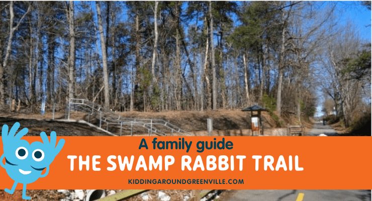
Northern Greenville County: Prisma Health Swamp Rabbit Trail System

The trail starts in Travelers Rest (often referred to as “TR”), the gateway to the Blue Ridge Mountains. What used to be a sleepy mountain town was transformed with the advent of the Trail into a hub for outdoor adventure. Today, TR is a destination in itself, not just a stop on the way to Caesars ​Head and Table Rock.

Local Swamp Rabbit Businesses

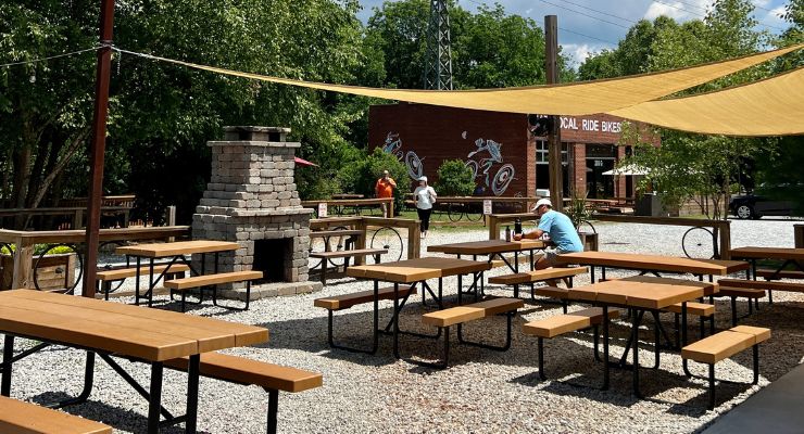
The trail system has become so intertwined with the legend of Greenville that dozens of local businesses have jumped on the train; for example, in Travelers Rest you will find the Swamp Rabbit Brewery & Taproom, Swamp Rabbit Inn, Swamp Rabbit Storage, and Swamp Rabbit Tees.
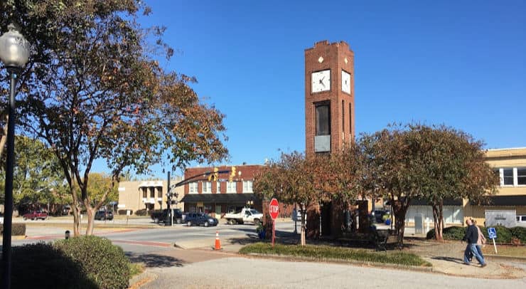
Travelers Rest

For ideas on what to do with a day in TR, check out this sample itinerary that includes parks, restaurants, and shops all within an easy walking radius. If your visit falls on a Saturday, be sure to stop by the TR Farmers Market in Trailblazer Park and check out the kids’ table that features a new activity every week. You can also rent bikes from Sunrift Adventures if you do not have your own, making TR the perfect place to start the SRT.

Furman University

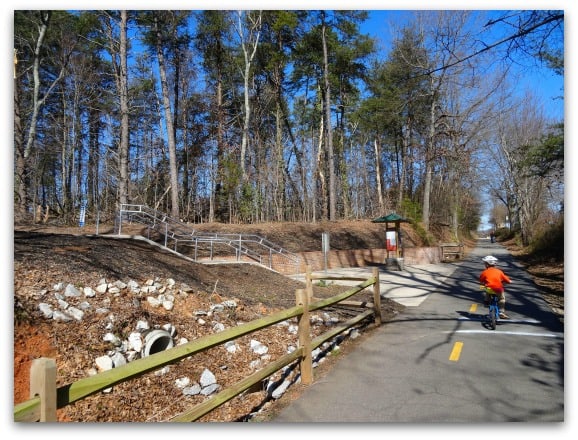
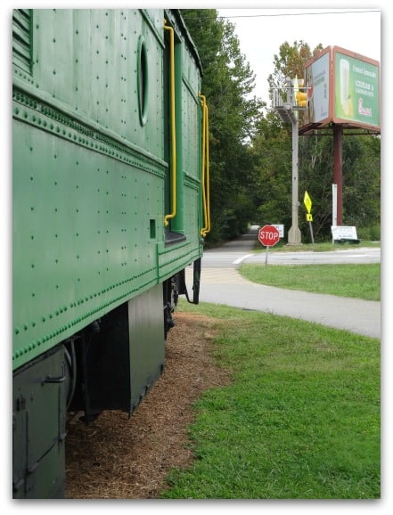
Soon after crossing Roe Ford Rd. (and passing mile marker 26) you’ll reach Furman University. A couple of access points allow visitors to connect to the path that circles Swan Lake, and just before Duncan Chapel Road (about MM27.5), you’ll spot the old rail car that marks the location of a public parking lot and rest stop. Be sure to check out the Kidding Around Furman University article for more on this beautiful campus!

South of Furman University

Just after the intersection of the trail with Sulphur Springs Road, you’ll find Swamp Rabbit Station. There is a pocket park at MM29 with train cars (a boxcar and locomotive) – a perfect stop for those kids who love everything train-related!

Old railroad car at Swamp Rabbit Station off of the Swamp Rabbit Trail in Greenville, SC.

Swamp Rabbit Café and Grocery

Then push on another two miles to reach the Swamp Rabbit Café and Grocery (MM31.5) and the outskirts of downtown Greenville.

Hampton Station Orange Line of the SRT

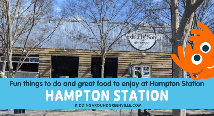
Once you begin your adventure from the Swamp Rabbit Cafe toward downtown, you can make a pit stop by veering off of the main trail onto the Orange Line of the SRT, and check out Hampton Station. Here you will find restaurants, a coffee shop, some breweries, and even art classes and axe throwing. Learn more about Hampton Station, and why it is a wonderful stop-off point on the SRT, in our KA Guide to Hampton Station.

Downtown Greenville on the SRT

Unity Park

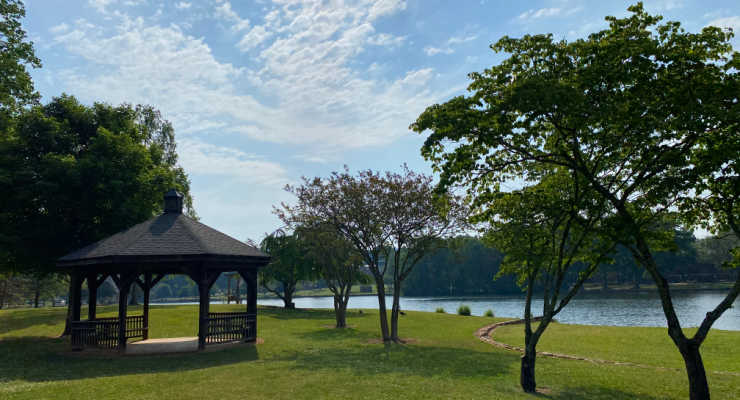
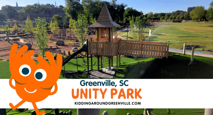
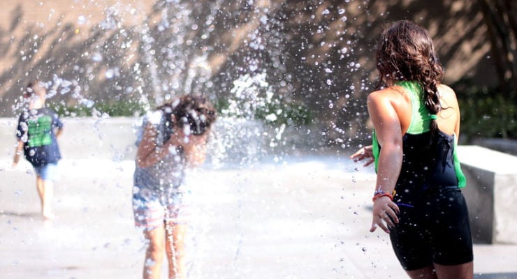
As you pass the Kroc Center and head toward Downtown Greenville, you come to Unity Park, one of the best places to ride the SRT. Here, you can grab food at one of the various places to eat, let your kids play at the immaculate park, hang out in the open fields, or explore the wetland preserve.

The Children’s Garden

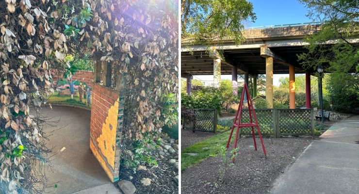
Where the Swamp Rabbit Trail turns to pass under South Academy Street, you know you’ve reached the Children’s Garden at Linky Stone Park (MM33.5), a perfect place to stop and rest before entering downtown.

Falls Park to Cancer Survivors Park

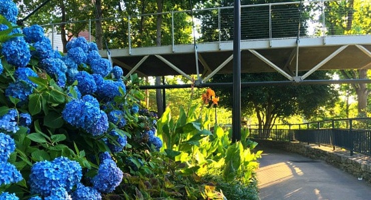
After passing through River Street underpass you’ll be right alongside the Reedy River all through Falls Park on the Reedy. There are dozens of adventures waiting for you here with trails leading every which way. Falls Park is a highlight of the trail you won’t want to leave! Regular trail users are pretty familiar with this portion of the SRT, simply because it is one of the best parts.

As you leave Falls Park, you will come across Cancer Survivors Park. Here, there are gorgeous gardens, statues, and memorial sites to take a rest and ponder over.

Learn more about Falls Park and what you can do there during your ride on the SRT.

Falls Park garden on the Reedy River

Greenville Zoo and Cleveland Park 

From Cancer Survivors Park,  it’s just a short ride to Cleveland Park. Cleveland Park is an old favorite; the trail passes Maj. Anderson’s memorial F-86 Saber jet fighter plane (MM35), numerous picnic shelters and playgrounds, and spur trails to the Fernwood Nature Trail and Greenville Zoo. 

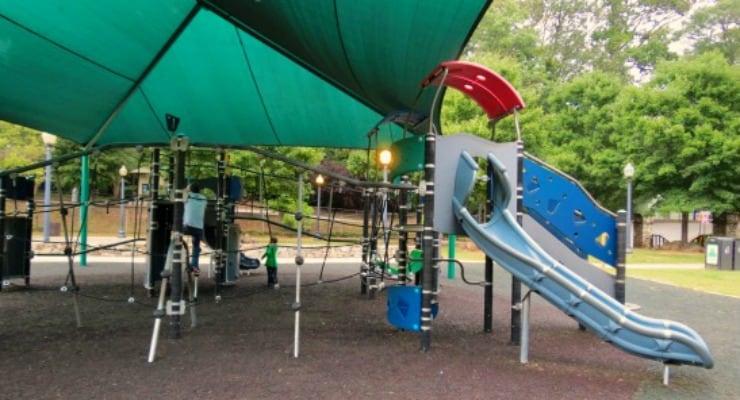
Once at the Greenville Zoo, you will find one of Greenville’s most popular children’s playgrounds which is filled with play equipment ranging from swings and monkey bars to slides and other amazing activities that will have your child moving. There are covered shelters with picnic tables within the park.

Green Line Extension

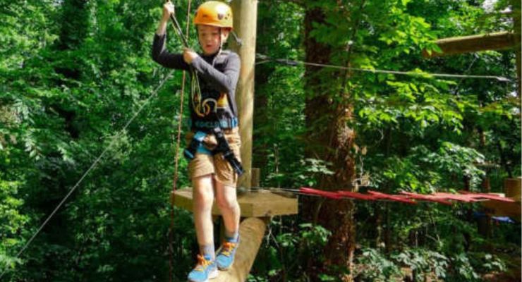
Opened in June 2023, the Green Line Extension was a major addition to the SRT. It connects the Greenville Zoo with Verdae Boulevard! There are plenty of places to stop along the way, including Holland Park, where you can hang out at a brewery, or even explore the aerial ropes course at Flying Rabbit Adventure. 

Flying Rabbit Adventure aerial ropes course in Greenville, SC.

Take the SRT Green Line Extension to Holland Park, where you can do an aerial ropes course at Flying Rabbit Adventure Park!

The Final Stretch of the Prisma Health Swamp Rabbit Trail System

The continuous trail currently stops just north of Greenville Technical College’s main campus, at South Pleasantburg Drive. It then resumes north of Lake Conestee Nature Park at Parkins Mill and Mauldin Road. There is then another large jump from Conestee to Simpsonville and a final jump to Fountain Inn.

There are suggested connection routes to take you to Conestee. These travel busy thoroughfares and aren’t recommended for younger cyclists. These segmented portions of the Swamp Rabbit Trail will hopefully be connected in the future! They are great for a short bike ride or walk while exploring the family-friendly downtown areas of Simpsonville and Fountain Inn, SC.
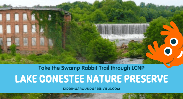
Conestee SRT Trail

However, once you reach Conestee you’ll find an oasis of calm. A spur trail within the park connects the trail system to Conestee Park (where the playground and dog park are), while the main trail winds around with the Reedy River to the historic Conestee Mill and dam. Here you’ll find a parking area and kiosk at the trailhead, mile marker 41, and the terminus of the Prisma Health Swamp Rabbit Trail System.

Simpsonville SRT Trail

The Simpsonville, SC portion of the SRT is another jump from Conestee to the heart of downtown. Here, you can ride from West Trade Street down Main Street Simpsonville for 0.93 miles. You will find dining options, places for a picnic, and more!

Things to do in Simpsonville, SC.

Spend the day in Downtown Simpsonville after riding the local portion of the Swamp Rabbit Trail!

Fountain Inn SRT Trail

The final stretch of the Swamp Rabbit Trail is located in Fountain Inn. It’s a large jump from Simpsonville to Fountain Inn. This portion is best explored when visiting the growing town at the bottom of Greenville County. You will find a 0.87-mile extension of the SRT at 107 Mt. Zion Drive in Fountain Inn.

Loop Trail in Laurens

The official beginning of the Prisma Health Swamp Rabbit Trail officially opened in 2023 with the two-mile Loop Trail. The trail is mostly shaded, and will hopefully one day connect to the trails fully into Greenville County as the expansion of the SRT continues!

For more information on the Prisma Health Swamp Rabbit Trail System, please visit the Greenville County Rec website, where you will also find a detailed trail maps. You can also text swamprabbit to 99000 for alerts about closures, special events, and more. Be courteous while your ride, and follow all road crossings safely. Happy trails!

A itinerary of some of the best places to ride the Prisma Health Swamp Rabbit Trail.

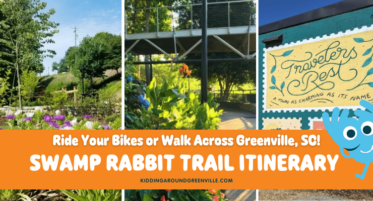
Swamp Rabbit Trail Itinerary: Fun Ideas for Using the SRT with Kids

If you are looking to enjoy the Prisma Health Swamp Rabbit Trail, but have young children who can only peddle (or be patient) for so long, explore one of these connections between fun places in Greenville County. 

  • Cleveland Park to Linky Stone Park: Downtown Greenville (~ 1.2 miles)
    • Begin at Cleveland Park, explore the monuments, and hang out under the trees as you pass by the gardens at Cancer Survivors Park. Then, cruise by the Medusa tree in Falls Park, and travel past the Liberty Bridge and the Peace Center until you reach Linky Stone Park. Here, you can explore a mini gingerbread-style house with your kids.
  • Downtown Greenville to Travelers Rest (~ 9 miles)
    • Begin in Falls Park, head toward Unity Park, and travel along the SRT past Hampton Station. You can continue on past Furman University, and head to Downtown Travelers Rest for lunch before heading back.
  • Greenville Zoo to Holland Park (~1 mile)
    • Begin at the Greenville Zoo and Cleveland Park and head toward Laurens Road until you reach Holland Park. This is a shorter trip and is great if you have younger kids. Take a pit stop at Holland Park and enjoy some delicious food and maybe a brew or two. This stretch of the SRT is part of the Green Line Connector and continues on toward Verdae Boulevard.

What’s your favorite portion of the Prisma Health Swamp Rabbit Trail System?

Swamp Rabbit Cafe right off of the Swamp Rabbit Trail

Moving to Greenville, SC?

Learn why the SRT is so iconic in Dan Hamilton’s Guide to the Prisma Health Swamp Rabbit Trail System!

30 Most Beautiful Places in South Carolina: Natural Spaces!

Posted on |

Introducing the most beautiful places in South Carolina, as you’ve never seen before! Join Kidding Around Greenville adventuring our way from the mountains to the sea, stopping at epic sites along the way. These spots were part of the 2021 SC7 Expedition, named South Carolina 7 for the seven wonders that we’ll explore on our journey, including National Geographic-recognized ecological areas, historical sites, and other natural wonders.

Thirty of the most beautiful natural places in South Carolina

The SC7 expedition across South Carolina

Looking for the 2023 SC7 expedition? Here are the events happening on the 2023 SC7 Expedition!

30 Amazing Adventures in SC
Day 1: OCONEE COUNTY – “Garden of the Gods”
Day 2: STUMPHOUSE & ISSAQUEENA
Day 3: EASTATOE PASSAGE
Day 4: ROUNDTOP MOUNTAIN
Day 5: SASSAFRAS MOUNTAIN – “Roof of the Palmetto State”
Day 6: JOCASSEE GORGES
Day 7: CHATTOOGA RIVER RAFTING
Day 8: MIDDLE SALUDA PASSAGE
Day 9:  KINGS MOUNTAIN NATIONAL & STATE MILITARY PARKS
Day 10: CROFT PASSAGE HIKE
Day 11: GLENN SPRINGS PASSAGE HIKE
Day 12: BLACKSTOCK BATTLEFIELD/MUSGROVE MILL
Day 13: ENOREE PASSAGE HIKE
Day 14: NEWBERRY PASSAGE HIKE
Day 15: PEAK TO PROSPERITY
Day 16: FORT JACKSON PASSAGE HIKE
Day 17: CONGAREE NATIONAL PARK – “Redwoods of the East”
Day 18: HISTORIC CAMDEN
Day 19: SANTEE INDIAN MOUND FIELDS
Day 20: MEMORIAL SERVICE FOR FRANCIS MARION at BELLE ISLE PLANTATION CEMETERY
Day 21: LAKE MOULTRIE PASSAGE
Day 22: CYPRESS GARDENS
Day 23: FORT FAIR LAWN REVOLUTIONARY WAR FORTIFICATION
DAY 24: SWAMP FOX PASSAGE – CANOE WADBOO CREEK
Day 25: AWENDAW PASSAGE HIKE
Day 26: BROOKGREEN GARDENS
DAY 27: EDISTO RIVER
Day 28: ACE BASIN
Day: 29 BULL ISLAND
Day 30: COOPER RIVER

(more…)

This Emerald Lagoon In North Carolina Looks Like A Fairy Tale, and You’ll Never Want To Leave

Posted on | 5 Comments

We heard about a place called Midnight Hole in North Carolina that featured an emerald lagoon, one that would likely have mermaids, or so we hoped.

Are you looking for a romantic day trip for you and the apple of your eye? A new place to take the family for a nature-inspired adventure? Midnight Hole in the Big Creek area of the Great Smoky Mountain National Park might be just the place for your next outdoor family quest.

Midnight Hole Emerald Lagoon, Western North Carolina
(more…)

An Upstate Outdoor Favorite: Paris Mountain State Park, Greenville, SC

Posted on | 3 Comments

Are you looking for a place to enjoy the great outdoors in Greenville, SC? Paris Mountain State Park, located 15 minutes outside the city of Greenville off State Park Road, is a staple to the Greenville outdoorsy community. You can hike over 17 miles of trails, mountain bike the ridge, and even take a swim with the kids in Lake Placid. The park has multiple trails of varying difficulty.

Plus, Paris Mountain has family-friendly camping sites that make camping more enjoyable. Find out all of the things the only state park in Greenville has to offer in our handy guide.

(more…)

Get 360-Degree Mountain Views at Bearwallow Mountain: Hendersonville, NC

Posted on | 1 Comment

Have you hiked the Bearwallow Mountain Trail? This easy trail in Hendersonville, NC lends itself to incredible, 360-degree views of the Blue Ridge Mountains. Here’s everything you need to know about the hike, plus some cool things to do nearby Bearwallow Mountain!

In the 10 years (or thereabouts) that we’ve lived in Greenville, we’ve yet to exhaust the list of hiking trails within an hour’s drive from the city. Not only are we constantly discovering new areas through friends and various groups, but trails are being established in newly-established conservancies and preserves through the efforts of groups like Conserving Carolina. One of our favorite late spring/early summer hikes is a comparatively new trail that leads to the summit of Bearwallow Mountain.

Bearwallow Mountain in Hendersonville, NC
Bearwallow Mountain Summit

About Bearwallow Mountain

Hendersonville-based Conserving Carolina acquired a conservation easement on the summit of Bearwallow in 2009, adding close to 400 more acres between the summit and trailhead in recent years. At 4,232 ft. this is the highest peak in the Bearwallow Highlands range that straddles the Eastern Continental Divide. The mountain is part of the Blue Ridge Escarpment and the western rim of the Hickory Nut Gorge, and views from the summit extend to Mt. Mitchell in the Black Mountains and Mt. Pisgah in the Great Balsams.

Conserving Carolina constructed the Bearwallow Mountain trail with the help of the Carolina Mountain Club, REI and community volunteers, and the hope is that eventually it will be incorporated into a 15-mile Upper Hickory Nut Gorge Trail, a loop that will link Bearwallow Mountain to CMLC’s Florence Preserve and the summit of Ferguson Peak. You can follow the progress of the trails in this area on the Conserving Carolina website.

On a recent warm summer day we took Poinsett Highway out of Greenville and then turned onto I-25 to cross into North Carolina. I had a momentary lapse of memory and thought I had forgotten our lunch on the counter, justifying a stop at one of the many stands by the side of the road to buy a bucket of freshly-picked strawberries. In another couple of months it’ll be peaches and apples… can’t wait! After jumping on I-26 towards Hendersonville, we took exit 49A for US Hwy. 64 east.

For further instructions see the Conserving Carolina website, but be aware that there’s a fork in the road that intuitively leads you off on N Bearwallow Rd. when you want to stay on Bearwallow Mountain Road.

Hiking up to Bearwallow Mountain Summit

The Bearwallow Mountain trailhead is at the crest of Bearwallow Mountain Rd. (Bearwallow Gap) where the pavement turns to gravel (the gravel road continues on over 2 miles to the town of Gerton, NC). Parking is along the shoulder, and the trail begins beyond the old, rusted gate. You’ll see the trail kiosk on the right, marking the beginning of the one-mile ascent up to the summit. The gravel service road that heads off to the left meets the trail at the summit and continues on to the historic fire tower and telephone towers. You can take either way to the summit.

If you take the trail, be prepared for switchbacks and rocky stairs almost the entire way. Rhododendron and trillium distracted us from the somewhat steep climb, but poison ivy kept us on the trail. As we neared the top we passed several rocky outcrops, before emerging into a grassy meadow which has nearly a 360-degree view of the surrounding states.

The gravel road is also a hike up but wide and easy, especially if you’ve got smaller kids. Dogs are allowed on the trail but they must be on leash.

The panoramic views up here are incredible. I love taking a picnic and hanging out at the top while just taking in all the beauty. Bearwallow Mountain is perfect for sunrise or sunset, just be sure to bring a headlamp.

If you’re lucky, you’ll get to see the grazing cows at the top but please just let them graze and don’t go up and try to cuddle with them. Even if you don’t see the cows, you’ll definitely see the cow patties so just watch your step.

Nearby Things to Do

There are several nearby activities if you want to make a day trip. We have an entire story on the Hendersonville area, which you’ll want to check out, but here are just a few of my favorites depending on what time of year you hike Bearwallow Mountain.

Spring & Summer

Nearby Lake Lure has a great beach to hang out at. You can swim or rent a kayak or paddleboard and check out the lake.

Next to the beach is the free Flowering Bridge, which is gorgeous! They have all types of flowers and I think spring and summer have the most beautiful ones.

Chimney Rock next to Lake Lure has an adorable village that my kids and I love to walk around at. There’s a great place next to Chimney Rock State Park to get ice cream and you can go gem mining.

During the summer months, people really love the free Fairy Trail at Bullington Gardens. There are little fair houses and trolls to find along the short path.

Fall

Late summer and fall is apple picking season and there are plenty of places to go within 20 minutes or so fo Bearwallow Mountain.

If you love apple cider donuts, then don’t miss our Apple Cider Donut tour near Hendersonville.

I think Chimney Rock State Park is best viewed during the fall because of the incredible fall colors (but really, that park is awesome anytime of year).

Did you know there’s a llama farm that you can visit most times of the year where you can hike with llamas or run with them through obstacle courses? Do not miss Ellaberry Llama Farm. It will make you happy for months after!

Winter

Go snow tubing at Black Bear Snow Tubing, right around the corner from Bearwallow Mountain. They’ve got a great lodge to get hot chocolate at as well.

Moonshine Mountain is also another fun spot to go snow tubing. Just get there early since they don’t take reservations.

Has your family explored Bearwallow Mountain yet?

The Ultimate Guide to All 47 South Carolina State Parks: Everything You Need to Know

Posted on | No Comments

Are you new to South Carolina and want to start getting outside and exploring our South Carolina State Parks? Are you a local who wants to branch out and try a new park for camping or hiking? We’ve put this guide together to help with your adventures! From the Upstate to the Coast, we have the details for all 47 South Carolina State Parks.

SC State parks

This article includes:
South Carolina State Parks in the Upstate
South Carolina State Parks in the Midlands
Coastal South Carolina State Parks
South Carolina State Park Passports, Annual Admission Membership Program
South Carolina State Parks Outsiders Incentive Program

(more…)

King Creek Falls: Hike along the Chattooga River to a 70-foot Tiered Waterfall in South Carolina

Posted on |

One of the best waterfall hikes around is King Creek Falls. SC only has a couple of accessible waterfalls that you can hike up to, so this waterfall is worth the trek. The hike to this 70-foot waterfall is 1 to 2 miles depending on your starting point. The waterfall’s reward is great for kids, with a pool fit for splashing and exploring. Find out all the details about this hike, how to find it, and where to park below.

(more…)

Stunning Views With No Hiking at Bald Rock Heritage Preserve Near Greenville, SC

Posted on |

Views from Bald Rock Heritage Preserve, under an hour from Greenville, SC, are reason enough to visit this beautiful spot. Here’s what you need to know to visit this pretty place. 

I can’t remember exactly when I discovered Bald Rock. Maybe it was when I was curious as to why lots of cars were randomly parked on the side of the road heading up to Caesars Head State Park. I imagine that may be how a lot of people discover this place. 

It’s certainly a unique place and one that takes hardly any effort in order to experience a breathtaking view of Greenville and Table Rock. 

Bald Rock near Greenville

Bald Rock Heritage Preserve

Bald Rock Heritage Preserve, a land that stretches 165 acres, is actually managed by the South Carolina Department of Natural Resources and is part of the Mountain Bridge Wilderness Area. There aren’t any signs that indicate where it is along the road but it’s easy to pull up on Google maps the parking area is about five miles south of Caesars Head State Park. 

Once you park at the pull-off, it’s a short, easy walk to beautiful views, which are the signature natural attraction. There’s a small wooden footbridge next to garbage cans that you walk across and then up granite, which opens to wide, beautiful views of the Carolina foothills.

There are pockets of granite that my kids like to think were made for them since they fit perfectly in many of these holes carved out by years of weather. There are also two headwater streams that run through the preserve, which provide an environment for rare fauna and flora.

There aren’t really hiking trails at the preserve but there is plenty of space for a picnic and to walk around the huge outcropping and explore the area near the streams in the woods, just part of the Bald Rock Heritage Preserve.

Clean Up Efforts

The mammoth granite dome has been vandalized with graffiti and excessive amounts of trash for the last several years, unfortunately. We always advocate following the seven principles of Leave No Trace when you enjoy the outdoors and it’s a sad sight when people leave a beautiful place much worse than when they found it. 

The Friends of Bald Rock, a volunteer-based organization that started in 2021, has led substantial clean-up efforts for the preserve. They’ve hosted several days of community-wide litter clean-ups and provided power washers to start removing the graffiti. On one day of cleaning up the preserve in October 2022, the volunteers collected more than 300 pounds of litter. 

They still have a long ways to go because the preserve has been so trashed in recent years (which isn’t the first place to be a victim of this kind of disrespect, unfortunately). People have had illegal fires, dumped entire cars off the rock outcropping, and strewn the area with broken glass and beer cans. 

If you’d like to help in the clean-up efforts, sign up for the email newsletter that Friends of Bald Rock sends out and see their calendar of upcoming volunteer events.

Fireworks, drugs, graffiti, alcohol, littering, and campfires are all illegal and perpetrators can be fined up to $465. If you see anyone defacing Bald Rock or using drugs, alcohol, shooting off fireworks, or the like, you can report them by calling 1.800.922.5431.

Enjoying the Preserve

My kids and I really love Bald Rock Preserve and usually stop there if we are hiking in the area. It’s always worth the stop to enjoy the views. We’ve taken our hammocks up there multiple times to read and even do our homeschool work. 

Hammocks at Bald Rock

Parents do need to be cautious about broken glass though. While clean-up efforts are on-going, there is still broken glass around, especially in the forested areas and even on the rock outcropping where people have had illegal campfires. 

Camping isn’t allowed by the way.

Pets are allowed at Bald Rock Preserve but must be kept on a leash. The preserve is open sunrise to sunset because of the vandalism. You don’t get a direct view of either the sunrise or the sunset but you will be able to see some beautiful landscapes.

Activities Near Bald Rock Heritage Preserve

Bald Rock Heritage Preserve is very close to Caesars Head State Park, which has miles and miles of hiking trails like the moderate Raven Cliff Falls hike and the Dismal-Naturaland-Gum Gap strenuous hike. The overlook at Caesars Head State Park is nearby as well and in the fall you can see the migration of hawks.

It is also near Wildcat Wayside Falls, Table Rock State Park, and Jones Gap State Park. Table Rock and Jones Gap have many miles of trails like the hard Table Rock Summit Trail and the moderately difficult Rainbow Falls Trail at Jones Gap.

Table Rock Summit
Table Rock Summit

If you’re headed to Pretty Place at YMCA Camp Greenville from Greenville, Bald Rock is on your way up there so it’s an easy stop. Additionally, Sassafras Mountain isn’t too far away. This beautiful spot is the highest point in South Carolina and you can drive right up to it and take a short walk to the platform. Fun fact: the platform splits North Carolina and South Carolina so you can literally stand in two states at one time.

Getting to Bald Rock Heritage Preserve 

To get to Bald Rock from Greenville, take Highway 11 to Geer Highway and go about 2.8 miles. The pull-off to the preserve will be on your right. There is usually a guy selling honey at a small table there. The preserve is about five minutes from Wildcat Wayside Waterfall and five miles from Caesars Head State Park. 

If you type in “Bald Rock Heritage Preserve” into a map, it will come up and give you directions. It’s a very popular place so you’ll see a lot of cars parked there during most times of the year.

Bald Rock Heritage Preserve
6600 Geer Highway, Cleveland, SC 29635