


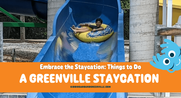


Do you want to enjoy beautiful views with no hiking at scenic overlooks near Greenville, SC? How about a driving tour of completely stunning overlooks, pull-offs, and scenic spots across Upstate South Carolina? If that sounds amazing, we thought so too! Here’s your guide to a no-hiking driving tour of gorgeous scenic places from KAG contributor, Liene.
Scenic Views Without the Hike
While my family loves a good hike (and there’s no shortage of them in the Upstate!), we sometimes look for stunning views without the effort of a long trek. Whether we’re hosting out-of-town guests who aren’t comfortable on the trail, traveling with a baby, or just keeping things low-key, we’ve found a dozen spots where you can pull up and enjoy a spectacular view with only a short walk. Visit one or two, or turn it into an epic driving tour for a scenic taste of the South Carolina Upcountry.
Wildcat Branch Falls
After breakfast at one of the many cute spots in Traveler’s Rest, head north to Cherokee Foothills Scenic Highway 11 and drive west. The first stop is Wildcat Wayside, an old rest stop for travelers on their way to Asheville.
With over a mile of trail that loops into the Mountain Bridge Wilderness Area, this trailhead is a popular spot. Be careful pulling in and out of the roadside parking area. However, you won’t have to go far to see the star attraction: a 30-foot waterfall visible from the road. The shallow pool at the base is a popular swimming hole on hot summer days!
Address: 5500 Geer Hwy, Cleveland, SC
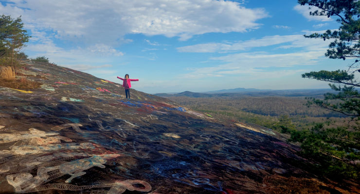
Bald Rock Heritage Preserve
Bald Rock Preserve was once a roadside pull-off, but in May 2025 it changed to a very short 0.4 mile hike. Please access through the new trail and not the old pull-off entrance! We’re keeping it on this list since the walk is easy, and we think the news are totally worth it. Bald Rock Heritage Preserve is 165 acres and home to several rare plants, as well as panoramic views stretching from Table Rock to downtown Greenville.
Address: 280 Persimmon Ridge Road, Cleveland, SC
Caesars Head State Park
Drive another 4.6 miles north on Highway 276 and you’ll reach the Caesars Head State Park Visitor Center. There is ample parking here, as well as restrooms, picnic tables, and a gift shop. Take the short, 0.1-mile trail to the overlook featuring a wonderful view of Table Rock and the reservoir.
Address: 8155 Geer Highway, Cleveland, SC
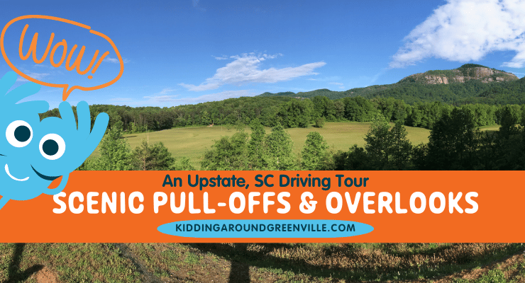
Grant Meadow Overlook
From Caesars Head, retrace your route back to Cherokee Foothills Scenic Highway 11 and continue west. Just under a mile after Aunt Sue’s Country Corner, you’ll see Grant Meadow Overlook on your right. This scenic pull-off is an Upstate Forever conservation easement that protects 57-acres.
Table Rock is the stunning focal point. Take a minute to read the historical marker that tells the story of the granite dome, or just soak in the view from the bench before continuing on to Table Rock State Park.
Address: Grant Meadow Overlook, Pickens, SC
GPS Coordinates: 35.034126, -82.684248
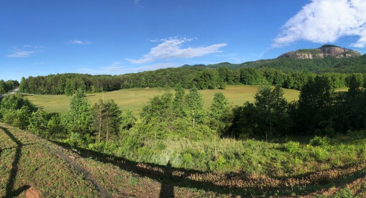
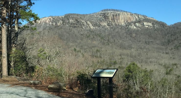
Table Rock Overlook
Table Rock Mountain rises 3,124 feet above sea level and is visible for miles. But if you want to get up close without the strenuous 7+mile hike, just head to the Table Rock Viewpoint within Table Rock State Park. It’s one of the most stellar mountain overlooks near Greenville, SC.
To access the pull-off you’ll need a state park pass (or pay admission). The viewpoint is halfway between the Table Rock Nature Center and Gaines Lodge parking areas. If the park is full or you don’t have a park pass, head instead to the Table Rock State Park Visitor Center on Lake Oolenoy. Here, you’ll find restrooms and a gift shop, plus rocking chairs on a wide porch with a prime view of Table Rock.
Address for overlook: 182-346 Table Rock State Park Road, Pickens, SC
Address for Visitor Center: 158 E Ellison Lane, Pickens, SC
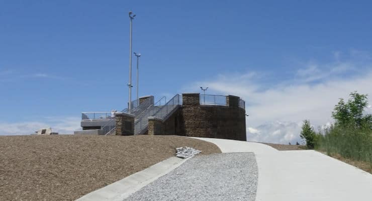
Sassafras Mountain
From Table Rock State Park, it’s another four miles or so to the intersection of Highway 11 and Moorefield Memorial Highway. Make a right and drive north 7.5 miles to Rocky Bottom, SC. Make another right on F. Van Clayton Memorial Highway (Sassafras Mountain Road) and take it all the way to the end to Sassafras Mountain Observation Tower. This is the highest point in South Carolina!
The distance between the parking lot and the tower is just over a tenth of a mile, but the short stroll is worth it. On a clear day, you’ll have 360-degree mountain views of North Carolina, South Carolina, and Georgia.
Address: 1391 F Van Clayton Memorial Highway, Sunset, SC
Jumping Off Rock
This next stop requires a bit of time and patience as it involves a long drive up a narrow gravel road. Once you’re back on Moorefield Memorial Highway, go north 0.9 miles to Horse Pasture Road. This road is generally open year-round, but closes in hazardous weather conditions. See SCDNR for updates. High clearance is recommended, but not required, for the 9.6-mile drive to the overlook.
On your way in, you’ll pass several Heritage Preserves and Wildlife Management Areas with multiple waterfall hiking trails and Foothills Trail trailheads.
At the top, look for a small pull-off with an obvious trail. From there, it’s only a couple hundred feet to the view. Jumping Off Rock is the first of several stops located in the Jocassee Gorges region in this driving tour that features views of Lake Jocassee. If you opt to skip it, you’ll get similar views from the Bad Creek Overlook.
Address: 448 Horse Pasture Rd, Sunset, SC
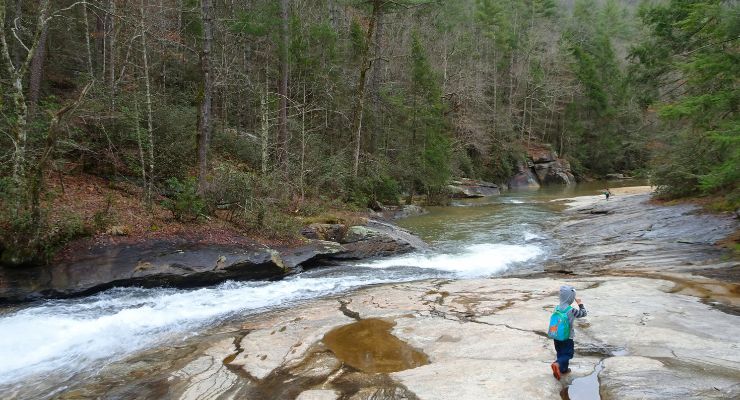
Long Shoals Wayside Park
Once back on Cherokee Foothills Scenic Highway, look for the intersection with Roy F. Jones Rd. After driving 1.4 miles west on Highway 11, you’ll see the entrance to Long Shoals Roadside Park. There are picnic tables located right next to the parking area, but this stop does require a short climb to reach Little Eastatoe Creek. While not as long as the walk to the Sassafras Mountain tower, it descends about 100 feet and is a bit steeper.
Address: Scenic Hwy 11, Pickens, SC
GPS Coordinates: 34.949246, -82.851151
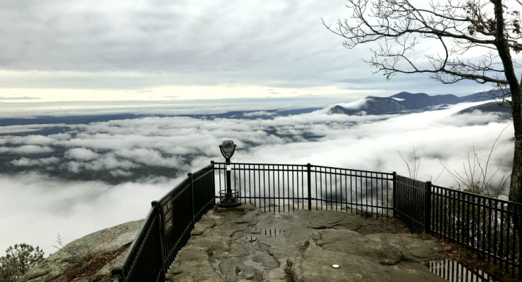
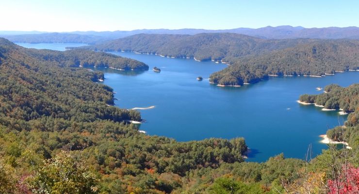
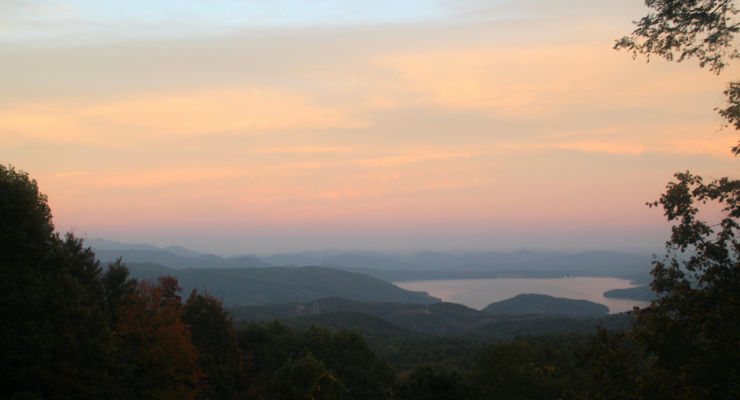
Bad Creek Overlook
From Long Shoals Park, drive west on Highway 11 for almost 10 miles. Turn right on SC-130 N and continue for 10.1 miles. Bad Creek is the site of the largest hydroelectric station operated by Duke Power and includes the 7,500-acre Lake Jocassee, a 375-acre upper reservoir, an underground powerhouse, and a one-mile-long tunnel bored through the mountain bedrock connecting the reservoirs and powerhouse.
The site is open to the public year-round. However, visitors must abide by the Bad Creek visitor regulations posted at the electronic gate at the entrance to the site, which is at the turn off from SC-130 N onto Bad Creek Road.
Proceed carefully on Bad Creek Road for 3.6 miles until you come to the entrance to the parking lot for the Bad Creek Visitor Overlook. This overlook has more breathtaking views of Lake Jocassee with a backdrop of the mountains of the Jocassee Gorges.
Address: Bad Creek Visitor Overlook, Bad Creek Road, Salem, SC
GPS Coordinates: 34.995363, -82.992124
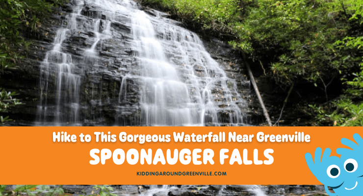
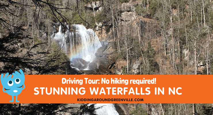
Note: Just to the north is the North Carolina border and Whitewater Falls, one of the tallest waterfalls in the east. We’ve chosen not to include it in this guide as the hike to the viewing platform is about 0.6 miles and involves stairs for the best view. It’s also a fee area. However, it’s close enough to be an option. The waterfall viewpoint is at the end of a paved 1/2 mile path without stairs! Read more about Whitewater Falls in our driving tour of stunning waterfalls!
Wigington Overlook
Once back on Whitewater Road, drive south for 0.7 miles, then turn right and head west on Oscar Wigington Memorial Highway. This short connector between SC-107 and SC-130 offers a fantastic bird’s-eye-view of Bad Creek Reservoir and the Carolina foothills from the Wigington Overlook, 1.4 miles from Whitewater Road.
Address: Oscar Wigington Memorial Highway Scenic Overlook, State Rd S-37-413, Tamassee, SC
GPS Coordinates: 35.001087, -83.043677
Sloan Bridge and Chattooga Pull-Offs and Picnic Areas
Continue west on Wigington Highway until you reach Highway 107, Falling Waters Scenic Byway. Just north of the intersection is the Sloan Bridge Picnic Area with restroom facilities and picnic tables. 2.3 miles south is Fish Hatchery Road, which leads to the Walhalla State Fish Hatchery, another picnic area, and a popular spot for fishing.
Sloan Bridge address: Sloans Bridge Access, Tamassee, SC (GPS Coordinates: 35.003620, -83.054143)
Walhalla State Fish Hatchery address: 198 Fish Hatchery Road, Mountain Rest, SC
Burrell’s Place Pull-Off
One mile south of Fish Hatchery Road is a memorial site for five service members who were killed when a B-25 Army Air Corps plane crashed into a mountaintop on March 10, 1943. At the Burrell’s Place Pull-Off, visitors can find a memorial marker with the names of the servicemen. 1/3 mile further is a wide spot in the road that has room for a couple of cars. There’s a view of Cantrell Mountain and the Upstate beyond.
GPS Coordinates: 34.964861, -83.078429
Russell Farmstead (Chattooga Town)
After cruising the rest of Falling Waters Scenic Byway, you’ll reach Highway 28S. Make a right and continue towards the SC/GA border. In 7.5 miles, you’ll reach the pull-off for Chattooga Town, a spot listed in the National Register of Historic Places.
The Russell house was a busy Appalachian farmstead in the late 1800s and early 1900s and served as a stopover for travelers headed to North Carolina to escape the hot South Carolina summers. A fire destroyed the main house and three outbuildings in 1988, leaving only a chimney of the main house. The foundations are still visible, and an interpretive sign on the site details the layout of the farmstead.
Address: Mountain Rest, SC
GPS Coordinates: 34.909300, -83.172708
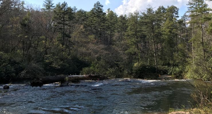
Chattooga River (Oconee County) Pull-Off
Retracing your route to Mountain Rest, SC, you’ll take Chattooga Ridge Road to Long Creek Highway. The next destination is where Highway 76 crosses the Chattooga. Just before the river is a 10-minute parking pull-off with room for about six cars and a walkway that leads to an overlook of the Chattooga River and the bridge. If you would prefer a closer look at the river, park at the US Forest Service Chattooga River Access site across the way. It will require a short walk.
Address: Highway 76 Chattooga River Access, Mountain Rest, SC
GPS Coordinates: 34.814151, -83.303892
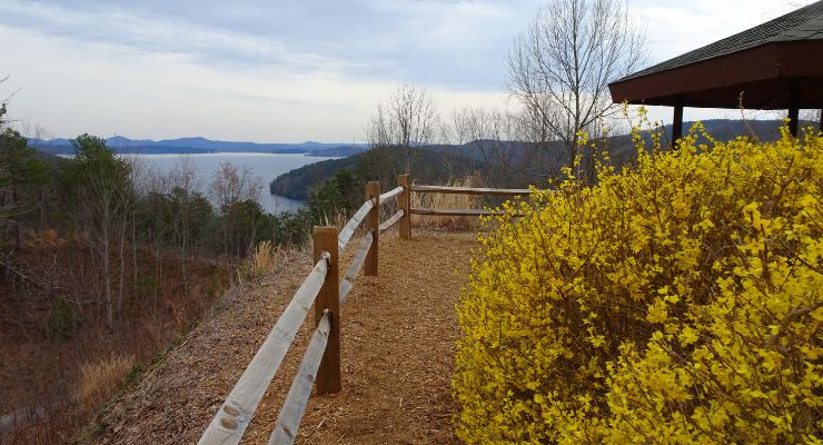
The fastest way back to Greenville from the Chattooga River is through Clemson on Highway 123. Though if you’re looking to take the scenic route (or headed to our starting point in Traveler’s Rest), you’ll want to take Highway 11. We often detour through Pickens to stop for food or watch the sun set from Glassy Mountain.
Pack that bag of gear and snacks, and hit the road with the Kidding Around Greenville guide to scenic viewpoints and pull-offs. Be sure to tag us in your photo posts to let us know which scenic pull-offs and overlooks near Greenville you enjoyed most!
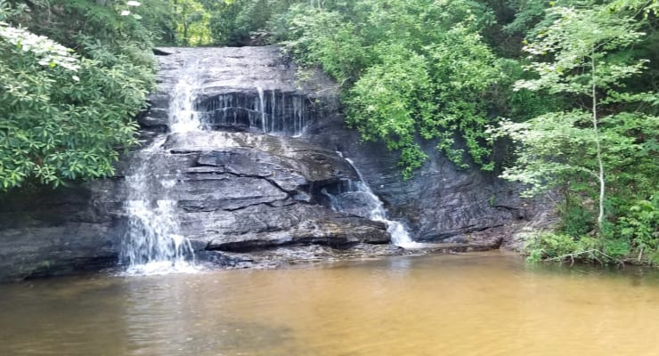
Love a good nature-filled driving tour?
Don’t miss this tour of Stunning Waterfalls With NO Hiking!

Find lots more outdoor adventures in our Kidding Around Guide to the Outdoors.
Check out parks, biking trails, swimming holes, and more!