


Looking for a campground that doesn’t require reservations months ahead? The Burrells Ford area is a great home base for a weekend of adventure, and KAG contributor Liene has all the details. You’ll find waterfalls, hiking, and an excellent campground at Burrells Ford Campground!
⛺What You’ll Love about Burrells Ford Campground:
- No reservations needed: First-come, first-served means you can plan a last-minute weekend without the stress.
- Two stunning waterfalls, great fishing, and miles of trails: Everything is close to your campground!
- Far enough to feel wild, close enough to make it by Friday night: about 90 minutes from Greenville.
Burrells Ford Campground: A convenient location and interesting background
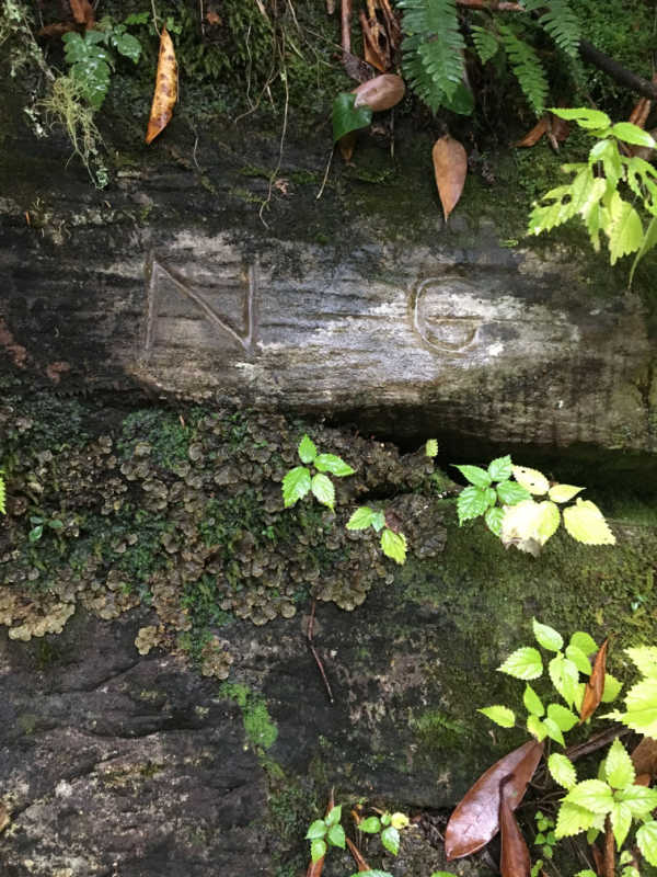
Despite being in a remote corner of the state, Burrells Ford remains a crossroads: historical and natural. The old wagon road (and later logging road) that forded the Chattooga was replaced with gravel Forest Service Road 708 (FS 708 or Burrells Ford Road) in 1968, allowing access to the section of the state bordering Georgia and North Carolina. Here, the Foothills Trail intersects with the Chattooga Trail and East Fork Trail. Ellicott Rock Wilderness overlaps the Wild & Scenic Chattooga River corridor.
Spur trails to Burrells Ford and Spoonauger Falls depart from multiple trailheads. And three National Forests – the Chattahoochee-Oconee, Nantahala, and Andrew Pickens ranger district of Sumter National Forest – converge to form one giant natural area.
But the region remains wild. Isolated, winding mountain roads require 1 ½ hours driving time to reach the campground from Greenville, including the last 3 miles on gravel Burrells Ford Road. At one point, those wishing to camp at the Burrells Ford campground could drive right to their campsite, but all that changed when the Chattooga River received the “Wild & Scenic” designation in 1974.
Now parking is in a lot just off the gravel road, and requires a ½ mile hike down the old roadbed to reach the campground.
How to Find the Campground and Nearby Trails
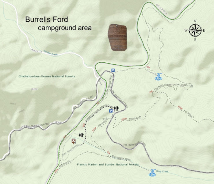
The confluence of trails can provide some confusion, and the mileages can be hard to pin down. There are two parking areas: one for the campground, and a second closer to the Chattooga on the edge of Ellicott Rock Wilderness. The Chattooga Trail (blazed green) stays along the river through the campground and emerges at this second parking area, while the Foothills Trail (blazed white) curves away from the river south of the campground and emerges adjacent to the campground parking area.
There are several connector trails from the Foothills Trail to the Chattooga Trail, as well as additional spur trails to the waterfalls. Add in to that East Fork Trail leading to the only other road in this corner of the state (Fish Hatchery Road), and a not-very-accurate map posted at the trailheads, and you have an idea of why you need to come prepared with a good map if you’re planning on doing any hiking.
We used National Geographic’s Sumter National Forest map on our Chattooga Trail hike, but later I utilized a Forest Service map to make a more detailed version of the campground area, as seen here.
About The Burrells Ford Campground
Close enough to Greenville that you would still have daylight to set up camp after a Friday evening arrival, or you could pitch camp Saturday and then spend the day exploring. Just make sure to park at the first parking area (for the campground), and then follow the road down to where you’ll have your pick of tent sites.
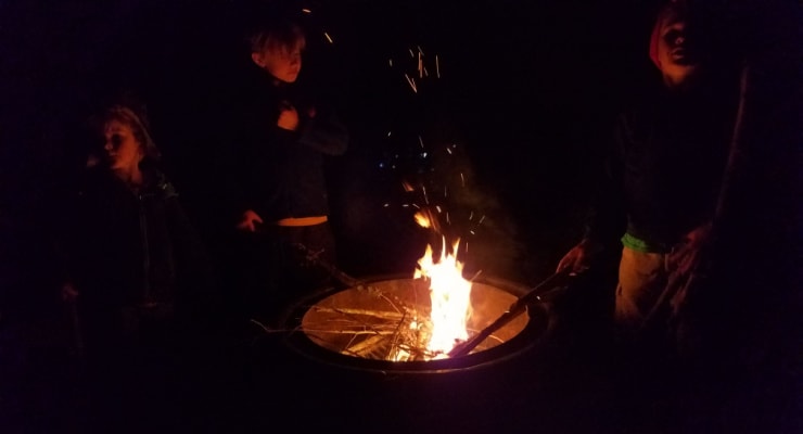
You’ve got bear-proof trash receptacles near the restrooms (in reality pit toilets, but luxurious compared to the alternative), and picnic tables, lantern posts, fire rings & bear poles in each campground. Some of the sites are right along the Chattooga, while others are scattered through the woods.
Remember to pack appropriately, as your return trip will be all uphill. The walk in possibly deters a portion of the car campers, and the campsites cannot be reserved ahead of time; plan accordingly.
Things to do Near Burrells Ford Campground
Hiking
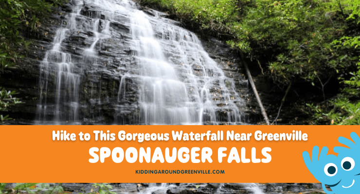
From the campground, take a hike to Ellicott Rock Wilderness following the Chattooga Trail; Ellicott Rock is about 4 miles north (one way), but scenic Spoonauger Falls is less than a mile. Or, head south on the Chattooga/Foothills Trail, destination Oconee State Park (16.4 miles), Ridley Fields (11.8 miles), the Bartram Trail junction (8.1 miles) or Cherry Hill campground (about 10 miles). Of course, you could just go ahead and hike the rest of the Foothills Trail – 59.8 miles to Table Rock State Park!
Fishing
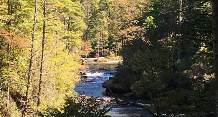
Burrells Ford is the gateway to some of the most premium trout water in the Southeast. The SC DNR stocks the river with rainbow, brown, and native brook trout grown nearby at the Fish Hatchery. The river is easily accessed from Chattooga Trail & most of the campsites, and even in October, the boys were happy to get their feet wet.
Waterfalls
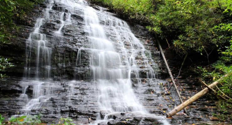
The high point of a stop at Burrells Ford is the proximity to two of the most picturesque waterfalls in South Carolina, King Creek Falls and Spoonauger Falls. King Creek Falls is just west of the campground, and is a 70-foot, tiered waterfall that is less than a mile, round-trip (about 1.4 there and back if you’re starting at the campground parking area). Spoonauger Falls is a 50-foot beauty, a short hike up a series of switchbacks from the Chattooga Trail.

This post was originally published on the blog Femme au Foyer.
Want to see more camping spots? There are a lot more options, and you’ll find some of our favorites here: Kidding Around’s Guide to Camping in Greenville, SC