


Have you hiked any of the Palmetto Trail as it crosses South Carolina? Kidding Around Contributor, Liene, has hiked many sections of the Palmetto Trail with her family. Her article is broken up by passage of the Palmetto Trail and location, so you can hike the section closest to you, plan a longer-distance adventure, or travel for a weekend getaway with some hiking.
Quick Summary: The Palmetto Trail
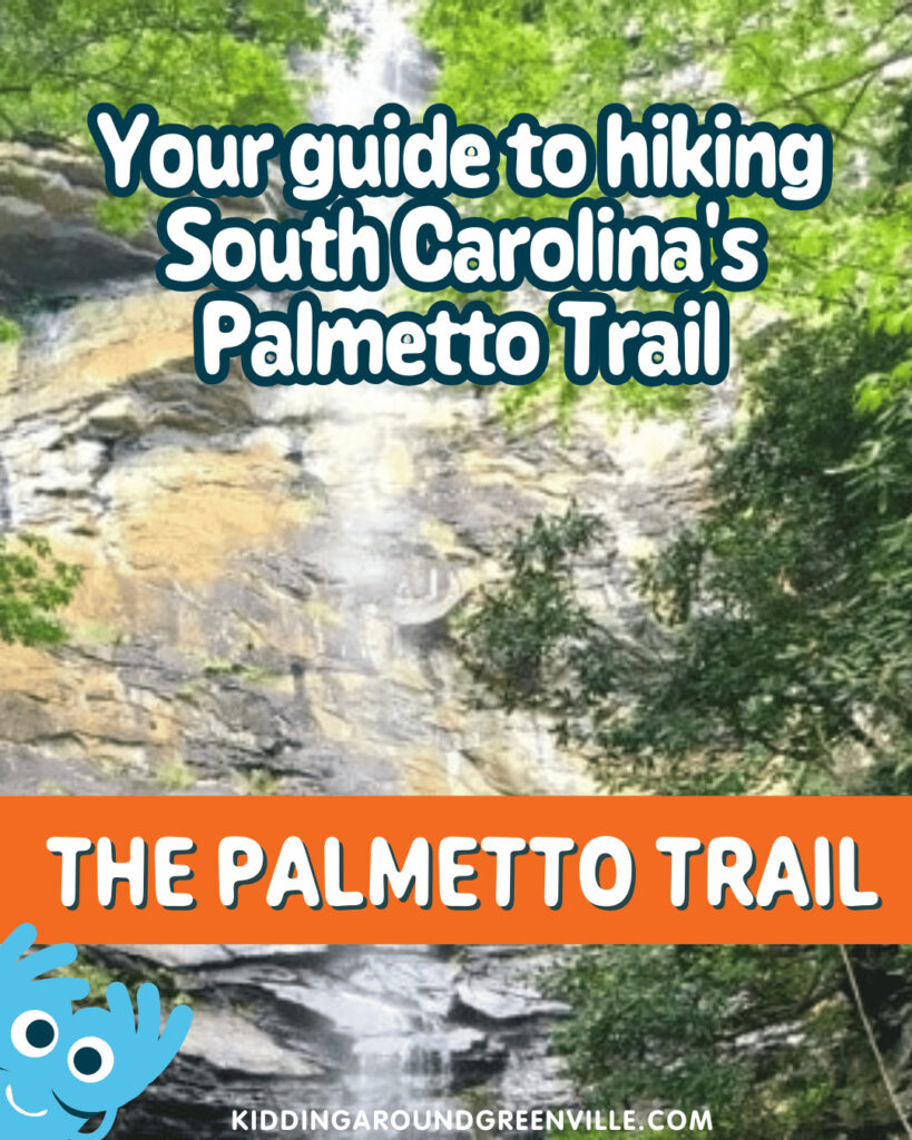
Stretching over 400 miles from the Upstate mountains to the Lowcountry coast, the Palmetto Trail offers something for every family:
• Easy strolls and epic thru-hikes
• Waterfalls, wildlife, and Revolutionary War history
• Mountain biking, horseback riding, and camping options
Whether you’re planning a weekend adventure or just a nature-filled afternoon, the Palmetto Trail makes it easy to explore South Carolina’s beauty.
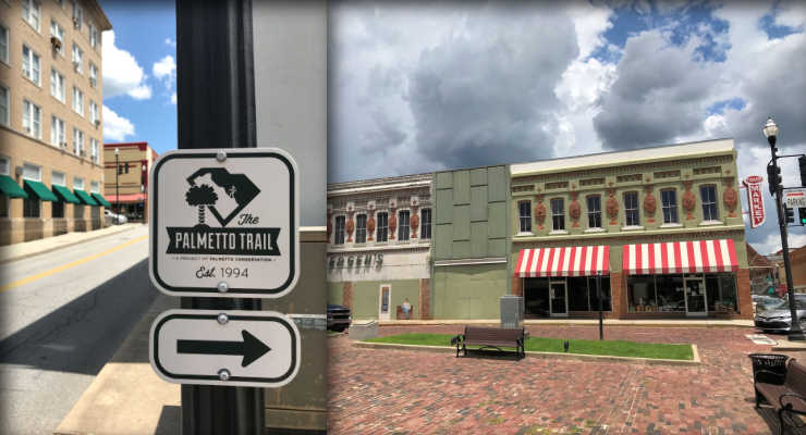
About The Palmetto Trail
South Carolina is fortunate to have not one, but two long-distance hiking trails traversing our beautiful state: the Foothills and the Palmetto Trails. From one side, Foothills Trail extends from Table Rock State Park to Oconee State Park along the foothills of the Appalachians. Another feature is that the Palmetto Trail traverses the entire state – from the mountains to the sea. Plus, almost half of it is within a couple of hours’ drive of Greenville!
Today, the 400+ miles of trail system connects state and county parks, national forests, nature preserves, wildlife management areas & Revolutionary War battlefields, and allow hiking & backpacking, as well as mountain biking, horseback riding, and camping on some passages.
Whether thru-hiking, or just out for a stroll, the trail explores the rich diversity and fascinating history, culture, and geography of the Palmetto State. Choose a passage, then head over to the Palmetto Conservation Foundation website to download maps and parking info; we’ve included links to corresponding articles on KAG, as well as to the corresponding Palmetto Trail page in our passage guide below.
The Palmetto Trail Passages
These tails are organized from NW to SE.
Stumphouse Passage: 1.5 mile hiking trail and 9.34 mile mountain bike park
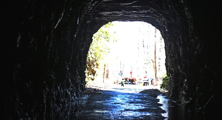
The Stumphouse Passage begins in Sumter National Forest at the Stumphouse Mountain Bike Park in Oconee County’s Walhalla. Stumphouse Mountain Tunnel is an incomplete railroad tunnel for the Blue Ridge Railroad of South Carolina, listed on the National Register of Historic Places in 1971. The park is also home to Issaqueena Falls.
Ross Mountain: 5.0 miles
The newest passage to be completed along the Palmetto Trail, this passage connects Stumphouse to Oconee State Park.
Oconee Passage: 3.73 miles
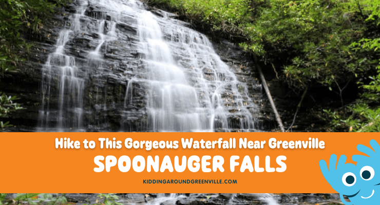
This Passage begins in Oconee State Park and ends at Oconee Station State Historical Site, a backcountry military garrison and trading post from the 1790s. Make sure to visit Station Cove Falls on the way! Intersections with other trails in this section allow easy access to Hidden Falls and the Foothills Trail.
Eastatoe Passage: 4.6 miles
Starting in Keowee Toxaway State Park on Natural Bridge Trail, this Passage travels along Eastatoe Creek upstream from Lake Keowee and climbs through mountain forest in the acclaimed Jocassee Gorges with its abundance of flowers, birds, and wildlife. Two new bridges including the Zeke wilderness trail bridge, were opened to the public in the last couple of years and are destinations in themselves!
Blue Ridge Electric Co-Op Passage (Jocassee Gorges): 12.6 miles
This section of the Palmetto Trail offers a view of the remote and rugged Jocassee Gorges area, with its abundance of wildflowers and wildlife, mountaintop vistas, and waterfalls. The Passage starts in Table Rock State Park, which boasts stunning trails such as the Pinnacle Mountain, Carrick Creek and Table Rock Trails. The Foothills Trail can also be accessed from the Park.
Roundtop Mountain: 5.9 miles
Connecting the Blue Ridge Electric Co-Op Passage to the Foothills Trail and Sassafras Mountain, this section creates opportunities for circular hikes in the Jocassee Gorges wilderness in Pickens County.
Middle Saluda Passage: 11.1 miles
With its waterfalls and challenging elevation, this passage connects about 14 miles of existing trails in the Mountain Bridge Wilderness Area of Jones Gap and Caesars Head State Parks. Highlights include Hospital Rock, Rainbow Falls, 420-foot Raven Cliff Falls, and camping in Jones Gap State Park.

Saluda Mountains Passage: 9.1 miles
The Saluda Mountains Passage runs along the ridge dividing the Carolinas, with the Poinsett Watershed to the south. The 19,000-acre watershed is a pristine wilderness area providing habitat for multiple rare plants and animals, including the threatened Peregrine falcon.
Poinsett Reservoir Passage: 6.6 miles
Poinsett Reservoir Passage travels the mountain ridges along the northern boundary of Poinsett Watershed. This pristine watershed of 19,000 acres contains the headwaters feeding Poinsett Reservoir of the Greenville Water System (GW).
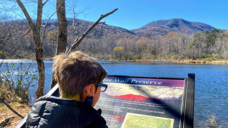
Blue Wall Passage: 14 miles
The Blue Wall Passage is home to a wide array of wildlife, stunning scenery including a 30-foot cascading waterfall, and 100+ species of birds. The eastern trailhead is located in the Foothills Equestrian Nature Center (FENCE), and country roads and sidewalks wind through Landrum and around lovely Lake Lanier before climbing the Southern Blue Ridge Escarpment to Vaughns Gap.
Peach Country Passage: 14.1 miles
Ideal for bicycling, the scenic Peach Country Passage is routed from Inman to Landrum along back roads dotted with peach orchards. Just past the sidewalks of Inman and Chapman High School, cyclists and hikers climb Windmill Hill, the highest point of the passage. https://palmettoconservation.org/passage/peach-country-passage/
USC Upstate Passage: 2.2 miles
This short passage begins on the campus of the University of South Carolina Upstate campus in Spartanburg, SC, and descends through the woods to Lawson’s Fork Creek.
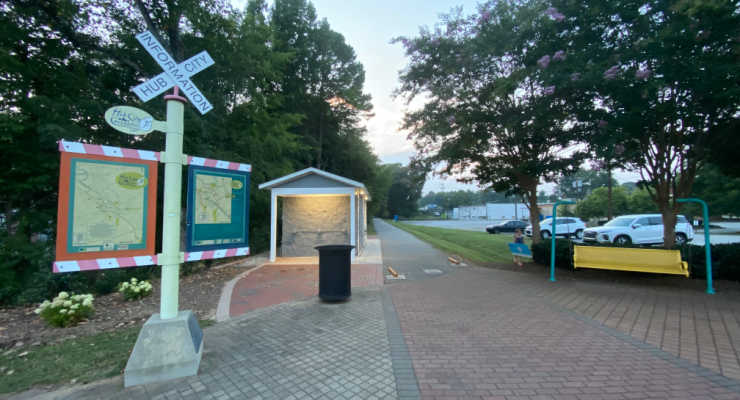
Hub City Connector: 12 miles
The Connector includes sections of greenways, bicycle lanes, and safe, signed sidewalks through the city of Spartanburg, traveling along the Mary Black Foundation Rail Trail and through Liberty Garden, and connecting the School for the Deaf and Blind with downtown, Converse College, Wofford College, Spartanburg Regional Heart Center, Spartanburg Medical Center, and USC Upstate. Trail spurs include Chinquapin Greenway, a 1.6-mile trail spur located at the city’s northern gateway.
Cedar Springs Passage: 2.9 miles
Cedar Springs links the Hub City Connector to the Croft Passage. The first mile of the passage is on the campus of the South Carolina School for the Deaf and Blind and is designed to meet the needs of the students of the School, and the trail is graded and surfaced to meet the design requirements of the Americans with Disabilities Act.
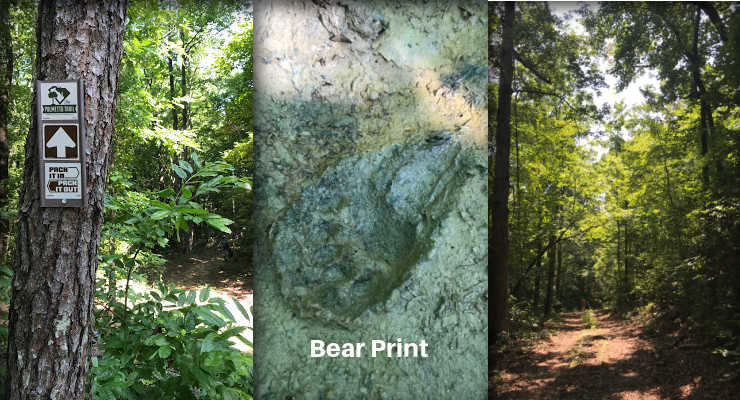
Croft Passage: 12.6 miles
In the 1700s, the area that today is part of Croft State Park was a hotbed of mills, trading, and political activity centered around the shoals. There was a Revolutionary militia victory at the First Battle of Cedar Springs in 1780, and during World War II it served as an Army training center. Note: this winter hiking article needs an edit, the Fairforest Creek footbridge washed away and has yet to be replaced. Also, please add some Palmetto Trail text and link to Croft article.
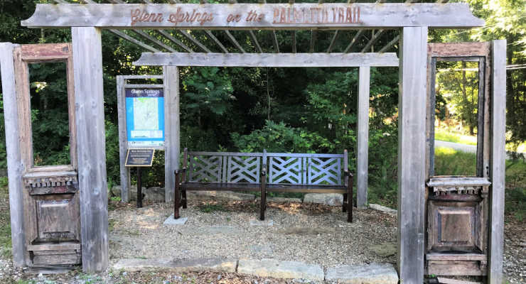
Glenn Springs Passage: 7.3 miles
Rolling farmlands, mature forests, and the historic town of Glenn Springs highlight the Glenn Springs Passage. In the 19th century, Glenn Springs was known for the health benefits of its mineral waters. Now listed in the National Register, the historic district includes 20 historic buildings from about 1840 to 1940 and the site of a popular resort hotel.
Blackstock Battlefield Passage: 4 miles
Enjoy four miles of nature trails, camping, and mountain biking along the Tyger River at the Blackstock Battlefield site where Revolutionary War patriots defeated the British; on November 20, 1780, patriot militia fighting under Gen. Thomas Sumter prevailed over British regulars under Lt. Col. Banastre Tarleton. Two months later Tarleton lost the Battle of Cowpens and fled north with his remaining troops.
Enoree Passage: 36.9 miles
Hike or bike the 36 miles of trail through Sumter National Forest linking Newberry, Laurens and Union counties. The trail meanders through the diverse habitats located in the Enoree Ranger District and River corridor, while Macedonia, Sedalia, and John’s Creek lakes provide plenty of opportunities to fish on the way to the northern trailhead at Sedalia Campground.
Lynch’s Woods Passage: 4.9 miles
This Park is a well-kept secret just outside of Newberry. Created by the 1930s Civilian Conservation Corps, the park protects 276 acres of woodlands full of old-growth hardwoods and the rambling Rock Branch Creek and tributaries, and allows hiking, cycling, horseback riding and camping.
Newberry Passage: 10.7 miles
The Newberry Passage is one of three urban passages on the trail, taking you through the heart of Historic Downtown Newberry and showcasing a number of historical and cultural points of interest.
Peak to Prosperity Passage: 10.7 miles
The highlight of this section of trail is the impressive 1,100-foot-long Broad River trestle. From there the former railway follows Crims Creek west through the Dutch Fork area.
Capital City Passage: 10.2 miles
The first urban passage on the Palmetto Trail features South Carolina’s largest city and seat of state government. The passage follows city sidewalks through Columbia’s neighborhoods, past city parks and schools, along the historic Horseshoe at the University of South Carolina, and across the steps of the State Capitol. The passage links Fort Jackson Passage to Riverfront Park and the Broad River.
Fort Jackson Passage: 16.3 miles
Fort Jackson Passage takes you through the heart and into the woods of this military facility located just east of Columbia, SC. Established in 1917 in preparation for WWI, the fort was named in honor of Major General Andrew Jackson. At 52,000 acres, it’s the Army’s largest basic training center.
Wateree Passage: 11.4 miles
This portion is one of the most diverse sections of the Palmetto. The trail crosses swamps and hills on its way from Poinsett State Park then through the SCE&G property to Hwy 601. Passing through a section of Manchester State Forest traveling along the remnants of the old SC Railroad through Sumter Junction, it crosses over the Wateree River and Molly’s Bluff – elevation 260 feet – with excellent views across Wateree swamp.
High Hills of Santee Passage: 11.4 miles
Named for the high, sandy ridges that are part of the Sandhills geographical region, these rolling hills are the remains of an ancient ocean shoreline found in the Carolinas and Georgia. Over time, the beach sand and shells transformed into coquina, which can be seen today throughout the park. In the 1930s, the Civilian Conservation Corps used the native stone to build many structures in the park. Birdwatching includes the endangered red-cockaded woodpecker.
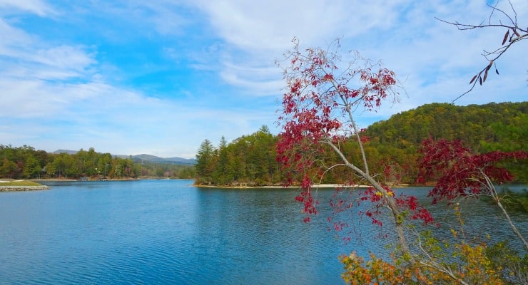
Lake Marion Passage: 35.9 miles
This passage skirts along the north side of Lake Marion between Santee and Mill Creek County Park. A short side trip down Fort Watson Road leads to the site of ancient Santee Indian burial mounds (3,500 years old); the site is now part of Santee National Wildlife Refuge.
Santee Passage: 13.9 miles
This passage utilizes the dirt roads and rural highways of Orangeburg County, traveling through farmlands to the town of Santee.
Eutaw Springs Passage: 21.3 miles
From the site of the Revolutionary War Battle of Eutaw Springs to downtown Eutawville, with a 5-mile spur trail that connects to Santee-Cooper Wildlife Management Refuge and Lake Marion.
Lake Moultrie Passage: 26.7 miles
Hugging the eastern and northern shores of 60,000-acre Lake Moultrie, the views make this a popular passage for mountain bikers. Following levees and service roads, the trail crosses the Santee Canal and traverses the swamps around Bulltown Bay.
Swamp Fox Passage: 47.6 miles
This passage named for Revolutionary War hero Francis Marion is the Palmetto Trail’s longest. From the swamps of Francis Marion National Forest, to long-leaf pine forests that are home to the endangered red-cockaded woodpecker, from the grassy savannas near Dog Swamp and Turkey Creek, to Wadboo Swamp; three trailheads provide users with plenty of options! Just make sure to bring plenty of water, as there is only one water source on the Swamp Fox Passage at the Ranger Station off Steed Creek Road.
Awendaw Passage: 7.1 miles
Awendaw Passtage is the coastal terminus of the mountains-to-sea Palmetto Trail. The trail’s namesake Trees greet users at the Buck Hall Recreation Area trailhead. Starting at the Intracoastal Waterway, the Trail meanders westward through maritime forest. It offers sweeping vistas of Lowcountry salt marsh along Awendaw Creek. At Walnut Grove, look for a scenic overlook and boardwalk. A canoe launch for Awendaw Creek is located at the end of Rosa Green Road.
More Ways to Experience the Palmetto Trail
The Palmetto Trail also formed the backbone of the South Carolina 7 Expedition, highlighting the 7 wonders of our state; you can read more about it in our article See South Carolina’s Top 30 Beautiful Natural Spots this July with the SC7 Expedition!
Please note, that while hiking the Palmetto Trail is free, the SC State Parks have an admission to enter the park, and some of the other passages require special consideration (such as Fort Jackson). Your best bet is to check the Palmetto Conservation Facebook for up-to-date info on parking, trail closures, and any special instructions before you hike.
Portions of this article originally appeared on the blog Femme au Foyer as Femme au foyer: Your Guide to the Palmetto Trail.