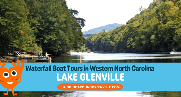
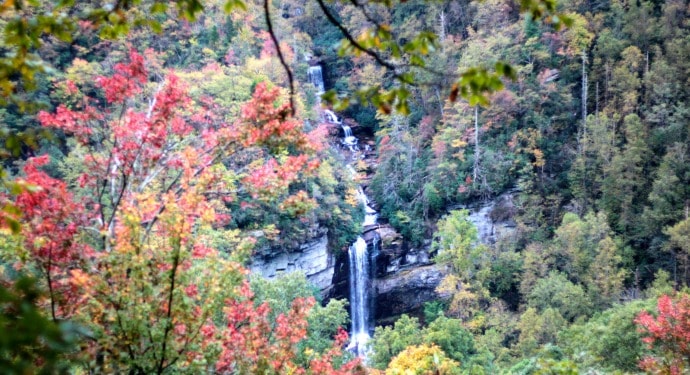
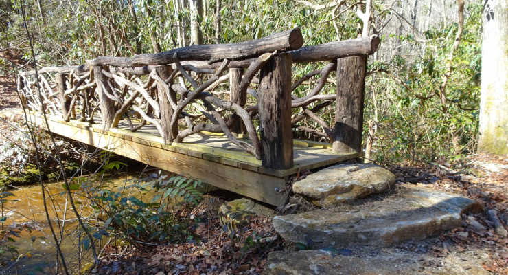
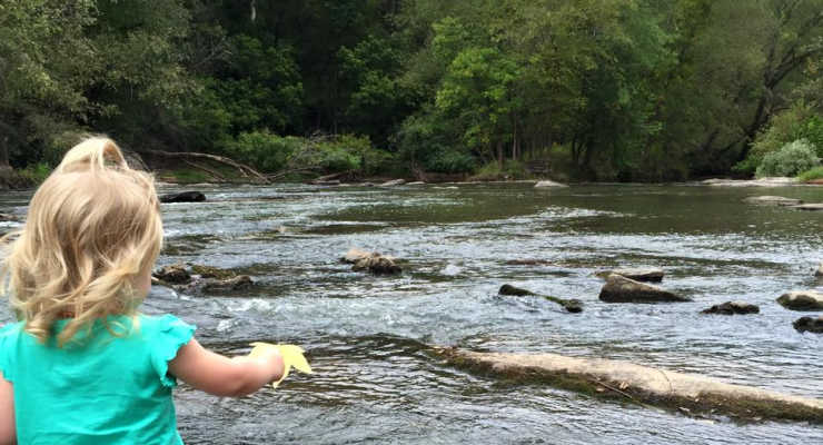
Inside: A local mom takes a boat ride on the highest Lake East of the Mississippi River at Lake Glenville, NC, and shares all the best tips to plan a trip there!
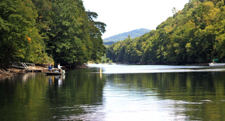
You can explore Lake Glenville, the highest elevation lake in the Eastern US, in Jackson County, North Carolina by boat with Lake Glenville Scenic Waterfall Cruises. We did the beautiful boat tour and will tell you all you need to know to enjoy the scenic lake.
Thanks to Jackson County, North Carolina for hosting us and providing the opportunity to take the boat tour.
There’s something really special about mountain lakes. Maybe it’s that crisp mountain air, the ancient hills that loom in the distance, that clear water – whatever it is, that’s where I want to be. So when I had the opportunity to take a boat tour with Captain Mark and his scenic boat cruise on Lake Glenville – the only boat tour company that operates on the lake – I was all in. We got to see waterfalls, a bald eagle nest, and enjoy the beauty of the lake. Plus, it’s only a short drive from Cashiers, so you can add it to your itinerary when visiting the area.
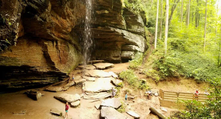
Looking for an unforgettable family nature experience that’s perfect for all sorts of weather? Ruby Falls in Chattanooga, TN checks all the boxes! This underground wonder stays a comfy 60 degrees year-round, offers incredible natural sights without the need for major hiking skills, and makes for an awesome adventure in the heart of one of Tennessee’s most vibrant cities.
💧 Ruby Falls: Fast Facts
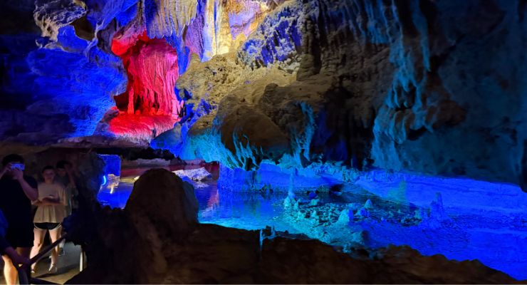
Height: 90 feet (just the visible part — it goes even higher!) Location: The waterfall is 1120 feet underground in Lookout Mountain. Getting there: Descend 260 feet underground in Lookout Mountain inside a glass-front elevator. Age: The cave is estimated to be 30 million years old Claim to Fame: The tallest underground waterfall open to the public in the U.S. Bonus: You’ll see it during a guided tour, complete with lights and music!
A Hidden Waterfall 1120 Feet Underground
Tucked inside Lookout Mountain in Chattanooga, Ruby Falls is home to the tallest underground waterfall open to the public in the U.S. You’ll start your journey with an elevator ride that drops you 260 feet below the surface, and that’s just the beginning.
Our family took the Cave Walk to the Waterfall, a one-mile round-trip guided tour to and from the falls that takes a little over an hour to complete.
Watch! Take a Closer Look at Ruby Falls
When the falls were first discovered in 1928, you could only reach the falls by crawling through narrow passageways, so a path was created to open the falls to the public. This path is fairly easy to walk through for a cave. It has lights, rails in parts, and is fairly smooth. The path is not wheelchair or stroller accessible, and it’s a cave, so there is moisture dripping at times on the floor and lower ceilings.
This particular cave tour focuses on the history of the discovery of the falls and the creation of Ruby Falls. It’s lighthearted and full of jokes. The formations that on the way to and from the falls are even named funny names based on what they look like, such as the “Steak and Potato”.
For those that are able to walk the full trail but might need more breaks, a Gentle Walking Tour is available that takes a slower pace and allows breaks to sit.
3 Reasons to Add Ruby Falls to Your Family Travel List:
It’s always the perfect temperature. Rain or shine, summer or winter — the cave stays a comfy 60 degrees year-round, making it a fun pick no matter the season.
It’s adventure without the stress. No extreme hiking here! The cave trail is smooth and manageable for most kids and adults, with lights and rails to help guide the way.
It’s got serious wow-factor. A 90+ foot underground waterfall with a light show? Yep, it’s just as amazing as it sounds — and it blew our teens away.
The Wow Moment: Ruby Falls
Let’s talk about that waterfall. Ruby Falls plunges 90 feet inside a cavern room, and it is every bit as dramatic as it sounds. A light show brings the falls to life, and honestly, it was beautiful. Everyone on the tour from teens to young children were impressed.
🕰️ How Ruby Falls Got Its Name
Back in 1928, explorer Leo Lambert was digging an elevator shaft into Lookout Mountain when he discovered a hidden cavern with a roaring underground waterfall. He named it Ruby Falls after his wife, Ruby — and thanks to his adventurous spirit, families can now visit this incredible natural wonder without having to crawl through narrow rock tunnels! Today, over 500,000 people a year come to see what Leo found nearly a century ago.
Know Before You Go: Ruby Falls Chattanooga, Tennessee
Bathrooms and food: Use the restroom before you head underground and grab a snack — there are no bathrooms or food on the tour.
Tours are timed: Once you’re in the cave, you’re committed. The tour doesn’t allow early exits, so gauge your child’s comfort level with dark, enclosed spaces before booking.
Lantern Tour option: While we didn’t try it, the Lantern Tour looks like a fun (and slightly spooky) alternative for older kids and teens. This tour is lit only by carried lanterns and has a smaller group.
Early morning and late evening tours tend to have smaller groups, especially during school holidays! Our tour was only around 20 people which made it easier to hear our guide and see the falls. Some of the tours can be as large as 50 people.
Flash photography isn’t permitted, but you can take non-flash photos during the tour and at the waterfall. You will not be permitted to stop to take photos on the route to and from the falls.
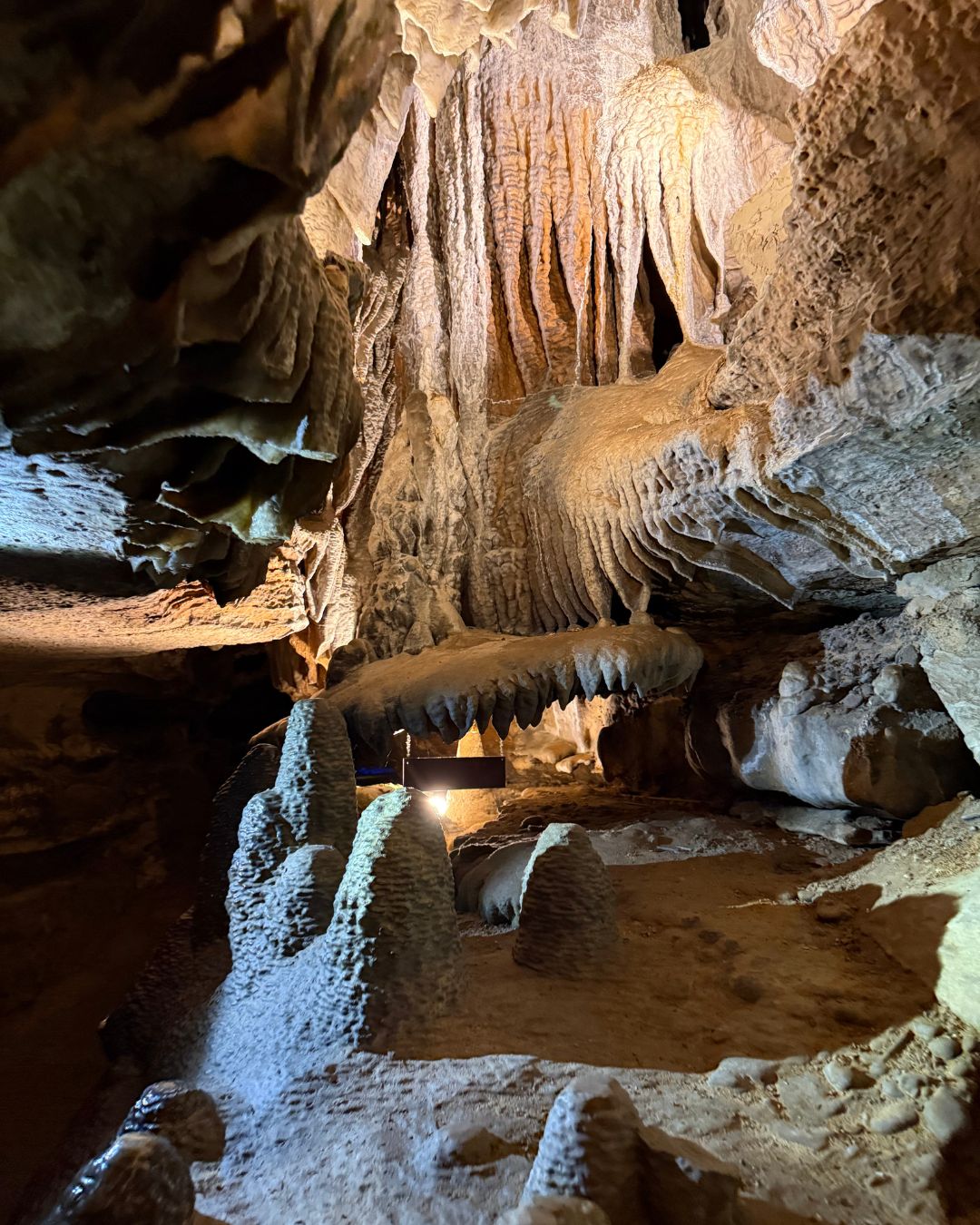
Beautiful formations inside the caves to Ruby Falls, Lookout Mountain
Don’t Miss the View
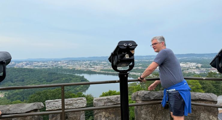
After the cave, we climbed the Lookout Mountain Tower, and it was an amazing view. You can see the Tennessee River, Chattanooga, and the Cumberland Plateau. It’s the perfect spot for a family photo after the cave tour.
Tips: Visiting Ruby Falls
Arrive 15-30 minutes early to check in and ensure you are on time for your tour.
Book online as tours often fill up.
Parking is free.
Flash photography isn’t permitted, but you can take non-flash photos during the tour and at the waterfall. You will not be permitted to stop to take photos on the route to and from the falls.
Wear comfy shoeswith good grips — the walk is just under a mile round-trip.
You may want a light jacket since the cave is around 60 degrees year-round.
Ruby Falls was the perfect mix of natural wonder, adventure, and family-friendly planning. We really enjoyed our visit and would add it to our list of must-see destinations in the Southeast.
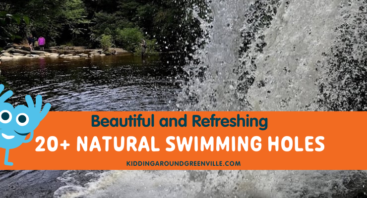
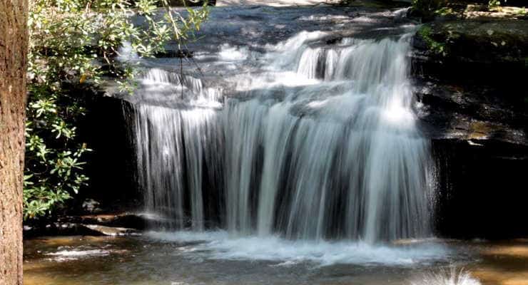
Inside: Beautiful swimming holes in North Carolina and South Carolina, with gorgeous pictures and info from parents who’ve visited these swimming holes.
Searching for swimming holes near me or places to swim near Greenville, SC? Cool off in the South Carolina heat with these beautiful natural spots perfect for swimming, wading, and splashing around. From shady creeks to clear lakes and rivers, these local swimming holes offer an easy escape into nature.
Pack your towels and swimsuits—whether you’re swinging into a natural pool, finding a magical hidden swimming hole, or just soaking your feet, there’s a perfect spot waiting for you.
Are swimming holes better than pools? We’ll let you decide.
🛑Note: Always check your destination before heading out. And be cautious in areas recently impacted by Tropical Storm Helene, as debris may still be in the water.
If you love swimming holes and want more, here’s a great list of Swimming Holes in North Georgia. Please pack a lunch and make it an awesome day trip adventure!
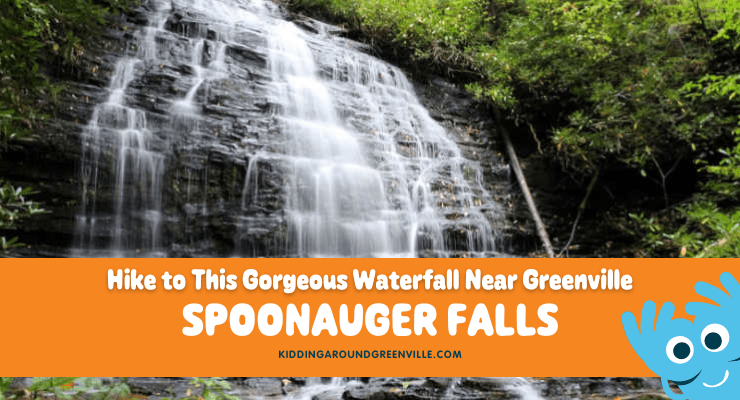
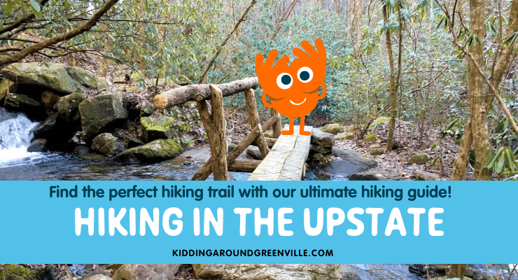
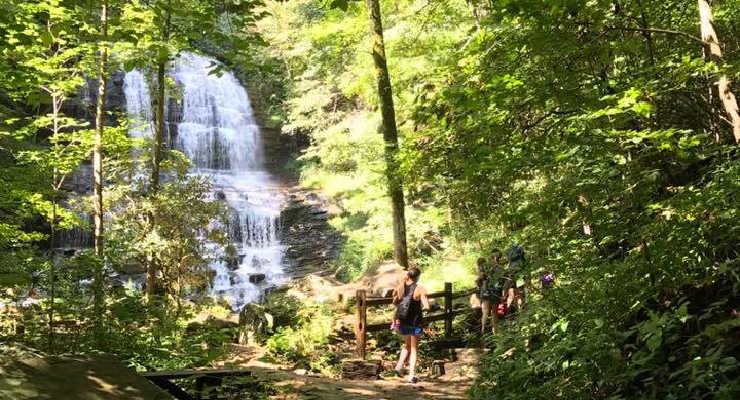
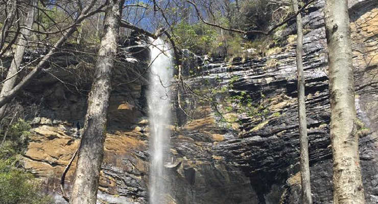
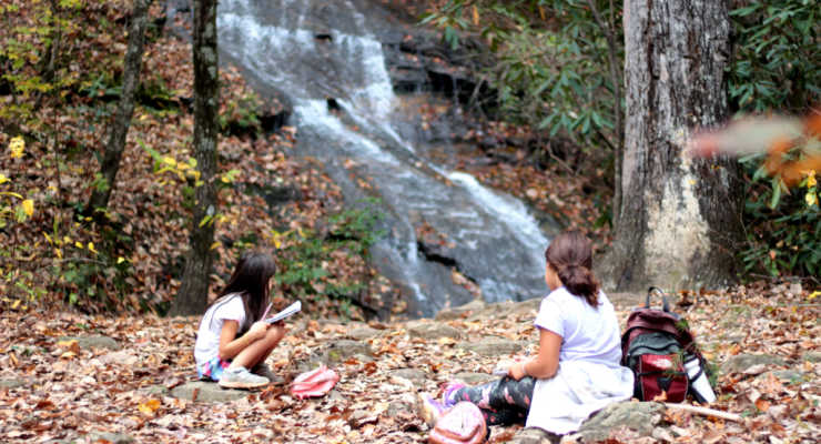
Are you looking for a family-friendly hike with a waterfall in the SC Upstate? KAG contributor Liene explores another one of the Upstate’s famed waterfalls, Spoonauger Falls! Part wilderness adventure, part waterfall magic, but entirely worth the drive to the Ellicott Rock Wilderness Area!
True Wilderness: You Can Access Spoonauger Falls With A Short Hike
The Ellicott Rock Wilderness spans three states, the South Carolina portion measuring 2,859 acres in the Andrew Pickens Ranger District of the Sumter National Forest.
Bordered on the west by the Chattooga River, there are three main means of access in SC: Chattooga Trail coming in from Burrells Ford, East Fork Trail from the Walhalla Fish Hatchery, and Fork Mountain Trail from Sloan Bridge Picnic Area. All three trails are strenuous treks into the backcountry.
However, on the south end of this remote area is a 50-foot waterfall reached by just a short trail from Burrells Ford Road – Spoonauger Falls. This hike embodies the spirit of the wilderness area, but is slightly more accessible; at just 0.3 miles to reach the base of the waterfall, it’s a perfect excursion for a family with small children!
We started our hike on Chattooga Trail from the trailhead on Burrells Ford Road. Parking is alongside the gravel road. Hiking north into the Wild and Scenic Chattooga River corridor, we passed several nice views of the Chattooga before coming to the Spoonauger Creek crossing.
The creek and the waterfall are both named for the Spoonauger family, which lived somewhere in the area above the falls. I’ve seen the waterfall called Rock Cliff Falls, as well as Spoon Auger Falls, however, the Forest Service maps indicate Spoonauger is the most commonly used name.
Immediately after crossing the creek look for the Spoonauger Falls sign, and follow the spur trail east. Just a short ascent later the waterfall is visible to your right – be cautious, as the trail can be slippery after a rain.
As always, exercise caution near waterfalls, and be aware that straying off the path can cause irreparable damage to sensitive plant communities, as well as allow for erosion on the steep walls of the gorge.
Things to See When You Hike to Spoonauger Falls
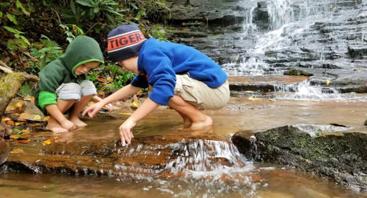
I have read that bats will roost in the rock crevices of the cliff, however, on our visit we didn’t see any bats, only salamanders in the pools below the falls. The waterfall is beautiful; in low flow it is a delicate lace, in higher flow a cascading veil.
Once you’ve taken in the falls, head back the way you came. The ramifications of the hemlock woolly adelgid are visible everywhere on this short hike, in the form of enormous dead and dying hemlocks, as well as egg sacs of the invasive insect, which resemble small tufts of cotton clinging to the underside of hemlock branches. The tiny brown-colored insect sucks nutrition from the tree’s stored reserves and injects a toxin while feeding, causing the tree to lose needles and not produce new growth. Death of the tree typically occurs 4 to 10 years after infestation, so although there are small hemlocks growing here and there, almost all the giants still standing are dead. While sad, it provides a good lesson to kiddos on how a small pest can take out a whole forest.
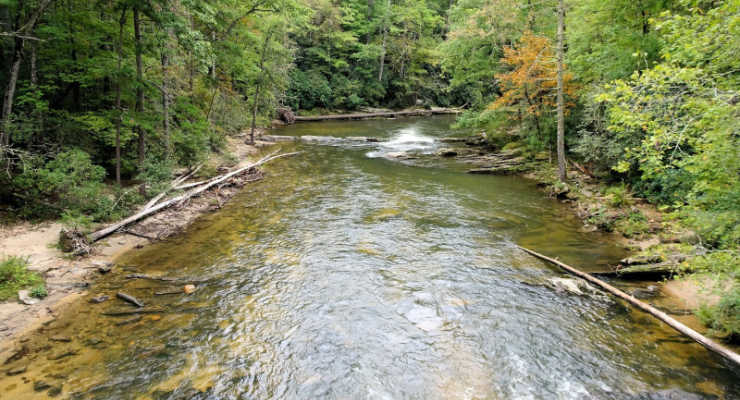
Chattooga River
Things to do Near Spoonauger Falls
Having returned to Burrells Ford Road, take a short stroll down to the bridge for a view of the scenic Chattooga River. Of course, make sure to cross into Georgia so that you can make this a two-state excursion!
Just a bit up the road you drove in on is another parking area, for the Burrells Ford campground. I often recommend this campground to friends wanting to get out for a weekend without the stress of reservations and fees: you can read about camping at Burrells Ford Campground here.
Another nearby waterfall hike is King Creek Falls hike – the 70-foot waterfall is under two miles from the campground parking area.
Plan your own trip to Spoonauger Falls!
Spoonauger Falls Near Mountain Rest, SC Ellicott Rock Wilderness
This post originally appeared on the blog Femme au Foyer.
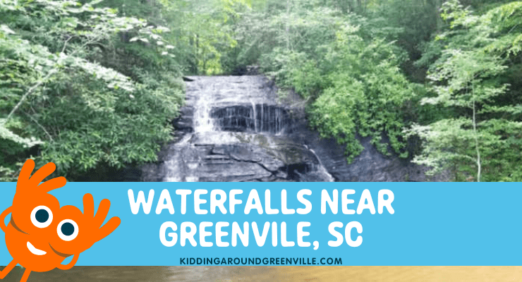
Are you wondering where to go to find some beautiful waterfalls without traveling too far from Greenville, SC? You’re in luck because we have gathered all the information you need about finding waterfalls close to home, all in one handy place! Whether you want to take in a waterfall while enjoying a long hike or a waterfall that you can view with very little effort, local mom Kristina has all the details right here!
Waterfalls can be quite magical and we have so, so many near us in the Upstate. Waterfalls are beautiful any time of year also – surrounded by wildflowers in the spring, framed by greenery over the summer and perfect for swimming, delivering fall colors in autumn, and showing off (some) frozen beauty in winter.
It is incredibly important for your own safety and for the safety of your family, EMTs, and rescuers, to never play at the top or sides of a waterfall, even for a second or to get an Insta-worthy photo. Those rocks are slippery and many people have unfortunately lost their lives at waterfalls in our area.
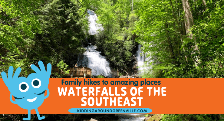
Below are some of our favorite waterfalls near the Upstate, SC. But, if you love waterfalls you’ll want to take a look at this list ofWaterfalls of the Southeast, loaded with waterfall hikes in South Carolina, North Carolina, Georgia and Tennessee.
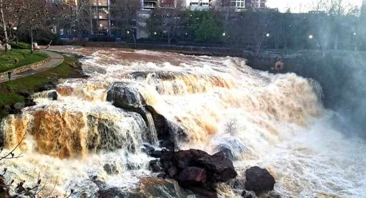
You don’t have to go far to see the first waterfalls on this list. Pack a picnic, relax on the nearby swings, or take a walk through Falls Park on the Reedy River in downtown Greenville and see the beautiful waterfalls that run right through our beautiful city.
South Main Street and Camperdown Way Greenville, SC Distance from Greenville: 0 minutes – it is located downtown
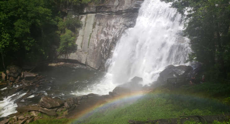
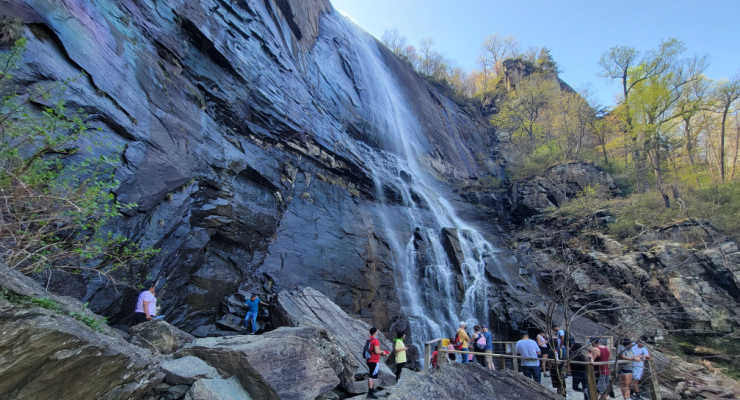
Raven Cliff Falls
Take the two-mile long Raven Cliff Falls trail to view the gorgeous 420-ft Raven Cliff Falls from an overlook at Caesar’s Head State Park. There are also a variety of hiking trails within that park and the surrounding Mountain Bridge Wilderness.
Or if you’re a more experienced hiker, take the Dismal Trail to get to the suspension bridge that goes over the falls. It’s a tough 8+ mile loop but worth it.
8155 Geer Hwy Cleveland, SC Distance from Greenville: ~hour
Jones Gap State Park [9/28: CURRENTLY CLOSED DUE TO DAMAGE FROM HELENE]
Known for its natural scenery, this 300 acre park is perfect for a relaxing day of exploration – and waterfall viewing of course. One of the more popular trails leads uphill to the stunning Rainbow Falls. It’s a strenuous trail but there are other waterfalls that are along the main trail.
This is a hugely popular park that now requires reserved parking ($5) on weekends in addition to the entrance fee.
303 Jones Gap Road Marietta, SC Distance from Greenville: ~an hour
Station Cove Falls
This waterfall in Oconee County near Hwy 11 is so, so stunning. It’s a big waterfall towering high dripping water from hundreds of small ledges. It’s also a very easy hike, about 1.5 miles round trip.
State Rd S-37-95 Walhalla, SC Distance from Greenville: an hour and 10 minutes
Station Cove Falls
Chau Ram County Park
A little over an hour from Greenville, Chau Ram Park is called South Carolina’s “Best Kept Secret” by the Oconee County Recreation and Tourism Department. There is a 40 foot waterfall at Ramsey Creek plus the county’s longest suspension bridge here. You can also swim, hike and camp, all for only $2 per car load.
1220 Chau Ram Park Road Westminster, SC Distance from Greenville: an hour + 5 minutes
Table Rock State Park
Table Rock contains lots of awesome waterfalls easily accessible from the many trails that wind through this beautiful park. Trails are not stroller-friendly so be sure to either bring a baby carrier if you’ve got a little one or sturdy shoes for the younger kids. There is a fee to enter the park if you don’t have a park pass.
158 Ellison Lane Pickens, SC Distance from Greenville: ~45 minutes
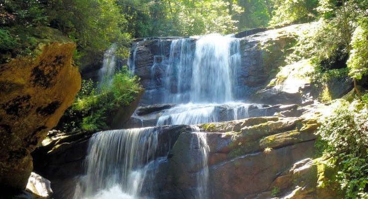
Yellow Branch Falls
Located in Walhalla near Isaqueena Falls, Yellow Branch Falls are amazing. The falls are huge and picturesque and just a beautiful place to visit. This is a popular waterfall and trail so again, get there early if you want to experience it with less people.
This wildly popular waterfall is right on the side of the road off 276 in Pisgah Forest in Brevard. We’ve seen it in every season and our favorite has been over the winter when it’s been partially frozen. No hiking is involved but you can take the stairs and ramps down to the bottom for some great photos.
This one is perfect for smaller kids to splash around in a waterfall without any of the hiking. The waterfall is literally on the side of the road on SC 11 in Cleveland, SC as you drive towards Table Rock from Greenville. There is an easy mile loop trail if you’d like to hike.
Heading north on Route 11, the trail and pull-off parking are on the right side of the road.
SC 11 Cleveland, SC Distance from Greenville: ~38 minutes
Wildcat Wayside
Issaqueena Falls
Located in Oconee County, Issaqueena Falls is located at the end of a short walk through what is known as Stumphouse Tunnel, which was originally constructed in 1852 to connect Charleston to Knoxville but was halted because of a lack of money.
As for the waterfalls, “legend has it that the falls is named for an Indian maiden, Issaqueena, who warning the white settlers of an Indian attack, was then chased by Indians and she appeared to jump over the falls. By actually hiding behind the falls (or some legend-tellers say she hid behind a stump, hence Stumphouse Tunnel), she tricked her pursuers and survived.”
Hwy 28 Walhalla, SC Distance from Greenville: an hour + 10 minutes
Wright Creek Falls
This is an extra special waterfall since you can only get there by boat. It’s on Lake Jocassee and you can access the lake through Devils Fork State Park. Here’s a map of the waterfalls at this stunning lake. There is a fee to enter the park.
161 Holcombe Circle Salem, SC Distance from Greenville: Devils Fork Park is an hour + 20 minutes plus another hour to 90 minutes of paddling (or take a boat through Jocassee Lake Rentals)
Spoonauger Falls
This family-friendly hike is located near Mountain Rest, SC, close to the Georgia border. The hike to the falls is an easy 0.3-mile hike, so it is perfect for families with small children. Once there, you can check out salamanders and small fish in the pools and discover the falls towering above!
Spoonauger Falls Near Mountain Rest, SC Ellicott Rock Wilderness Distance from Greenville: 1 hour 55 minutes from Downtown Greenville.
Rainbow Falls at Gorges State Park
This is a different Rainbow Falls than at Jones Gap. You’ll have to travel into NC to see this beauty! If you’re lucky, you’ll get to the see the rainbow that gives it its name. The hike is a moderate 4 mile roundtrip hike.
Gorges State Park 976 Grassy Ridge Road, Sapphire, NC Distance from Greenville: 90 minutes
Rainbow Falls
Little Bradley Falls
Several creek crossings and a moderate incline make the hike to Little Bradley Falls a little bit challenging. But the beauty of these falls, and the chance to cool off in the creeks, make this hike a great choice.
Little Bradley Falls Holbert Cove Road, Saluda, NC Distance from Greenville: 1 hour
Find More Waterfalls to Explore!
Our huge guide to waterfalls of the southeast tells you all about waterfalls you can hike to in the Georgia mountains, South Carolina, North Carolina, and Tennessee. They make a beautiful day trip or addition to a family getaway.
Are you looking for a beautiful place to enjoy the outdoors with your family? Consider a trip to Anna Ruby Falls. It is so worth the drive from nearby Helen, GA to enjoy this beautiful double waterfall. We love the paved trail that keeps this gorgeous spot accessible for so many. We have all the details to help you plan your visit to Anna Ruby Falls, Georgia.
About Anna Ruby Falls
Located adjacent to Unicoi State Park Anna Ruby Falls is actually a spectacular twin waterfall, as two waterfalls combine to form Smith Creek. The taller waterfall cascades down 153 feet and its twin drops about 50 feet. There are many gorgeous waterfalls in North Georgia, but this one is unique. Not just because it’s a double waterfall, but because the trail is paved making this a really family-friendly spot to enjoy nature.
The Anna Ruby Falls Trail
The paved hiking trail begins at the Anna Ruby Falls Visitor Center where you will find restrooms and a gift shop, plus several scenic picnic areas along the creek at the Anna Ruby Falls Recreation Area.
It’s just under a mile hike along the paved trail to get to the falls and back.
The paved down-and-back trail to the falls has a moderate to steep incline at times, as it follows the boulder-lined banks of Smith Creek to the falls. While there are a few steep sections, the trail is well-maintained and the pavement makes the trip much easier.
It’s a very pretty trail, and though short, it’s worth a trip in and of itself. There are multiple overlooks and observation decks to enjoy the falls for a while before returning back down the trail.
Lion’s Eye Trail
Near the parking lot, you’ll also find the very short Lion’s Eye Trail. Its a 0.1 mile paved trail with braille interpretive signage.
Near Anna Ruby Falls
You’ll find Anna Ruby Falls just a short drive from Helen, GA and right next to Unicoi State Park.
How far is Anna Ruby Falls from Helen, GA?
It’s about a 15-minute drive from Helen, Georgia to get to Anna Ruby Falls. It’s a beautiful area. So whether you start your day in Helen and head to the falls, or begin with a hike and end with a trip to Helen, make sure to do both. The alpine town is quite unique. Check it out in our piece on Helen, GA.
We love to grab a pretzel when we visit Helen! The holiday decorations are always fun, too!
You’ll drive through a portion of Unicoi State Park on your way to the gate to Anna Ruby Falls. If you’re looking for more hiking, the hike around the lake at Unicoi State Park is pretty and family-friendly.
Our family always stops at Sweetwater Coffeehouse when we are in the area. The staff is so friendly and it’s just a super cute mountain town coffee shop. We found it by accident as we drove through the area on our first visit and now we make a point to stop whenever we are in the area.
They are open 8 am to 6 pm daily, and it’s about a 20-minute drive from the falls parking area to Sweetwater Coffee.
Anna Ruby Falls Recreation Area, National Forest 3455 Anna Ruby Falls Road, Georgia Fee is $5 per person aged 16 and up. Free for kids 15 and under. Open 9 am to 5 pm daily- last admission is 4 pm. Closed the Wednesday before Thanksgiving, Thanksgiving, Christmas Eve, and Christmas Day.
Looking for a day away from it all out in the woods? Then definitely plan a visit to Dupont State Park waterfalls in western NC. On a fall day there is nothing like heading north to the streams, fresh air, dazzling waterfalls and fall colors of the Blue Ridge Mountains. With its 900 miles of hiking trails, six major waterfalls and over 10,000 acres of forest, DuPont State Forest is a showcase of some of the most fabulous scenery in western NC, just an hour from Greenville! KAG Contributor Liene is telling us all bout the best places to visit in Dupont State Forest.
Find even more great hikes on our Hiking Guide. Plus find tons of waterfalls in our area to visit here!
This article was originally published on Femme au Foyer as “DuPont State Forest and its waterfalls”.
What to expect if you visit Dupont State Park
To maximize a visit to DuPont, park in the Hooker Falls area on Staton Road and combine the Triple Falls Trail, the High Falls Trail and Hooker Falls Road for an unforgettable, three mile hike to visit three of the most popular and beautiful falls in the area. Two of them (Triple and Hooker Falls) you might recognize from the movie The Hunger Games, a portion of which was filmed in DuPont in 2011, and Triple Falls featured prominently in the movie Last of the Mohicans.
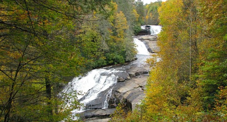
Just a short ½ mile from the Hooker Falls parking area you’ll reach Triple Falls, with three distinct cascades that drop 120 feet in total. The first overlook is just a short distance from the parking lot, and a few hundred feet further is the spur trail that leads down to the large rocky area between the falls. Bring a picnic to enjoy the spectacle – natural and human – before jumping back on the main trail.
Triple Falls trail and High Falls trail form a loop, but you can choose to stick close to Little River on High Falls trail and cut out a bit of the mileage by doing a there-and-back. (Triple Falls trail heads west, hitting Buck Forest Road and intersecting with High Falls trail and the Covered Bridge Trail about 1/3 mile from High Falls). To reach the base of the 150-foot cascade, take a detour on the short River Bend spur trail for a memorable view of the falls and the covered bridge at the top.
High Falls is the largest waterfall in the area, and together with the beautiful covered bridge was part of a planned real estate development in 2000. After a lengthy legal battle the state was able to purchase the land from the developer, ensuring the view of the falls would be preserved. The trail leading to High Falls is somewhat steep, so make sure to bring water and to set a comfortable pace in the summer heat.
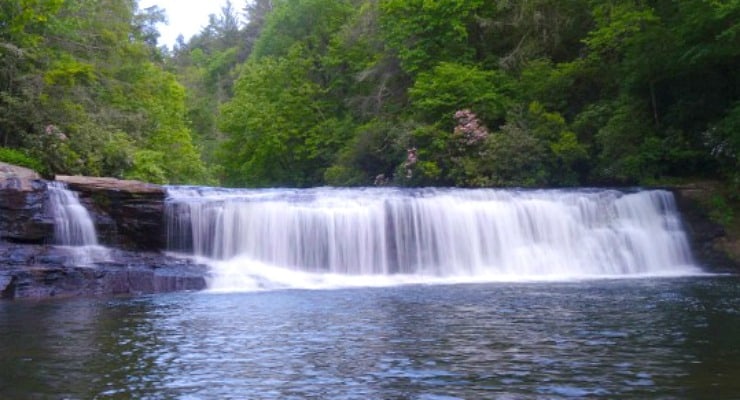
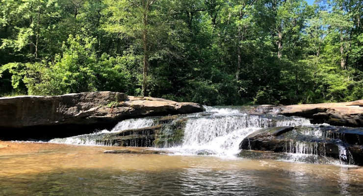
Once you’ve retraced your steps to the parking area and crossed back under Staton Road, you’ll turn west on Hooker Falls trail. Make sure to pause at the observation area above the falls before circling down to the base of the 12 foot waterfall. From the popular swimming hole at the base of the falls, Little River flows on into Cascade Lake, outside of the state forest’s boundaries. The hike to the falls is relatively easy, a mildly sloping 0.4 miles down a gravel road.
These three DuPont waterfalls make for a perfect year-round destination. The weekends during the summer will find a crowd at Hooker Falls, cooling down in the natural swimming hole, meanwhile autumn brings unparalleled fall foliage to the views around High Falls. Winter will decorate the waterfalls in ice, and finally spring means wildflowers and the return of the Blue Ghost Firefly. Whichever season you visit, you’ll find the scenic and tranquil beauty of DuPont State Forest and its waterfalls a memorable experience you’ll want to repeat again and again.
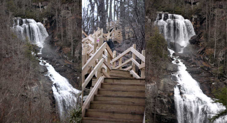
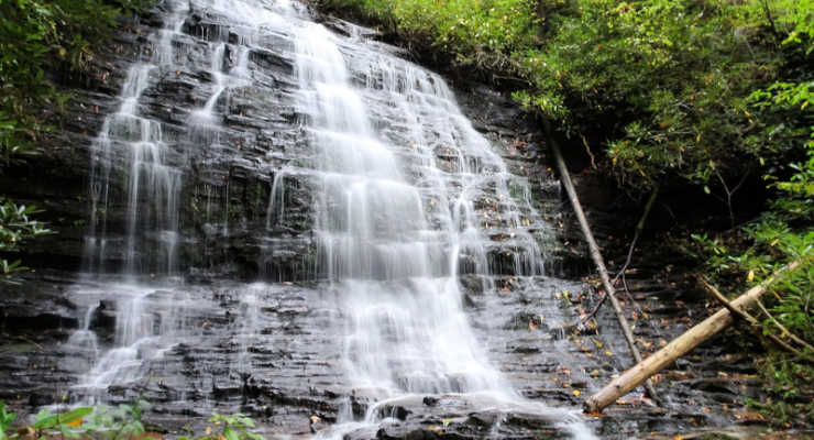
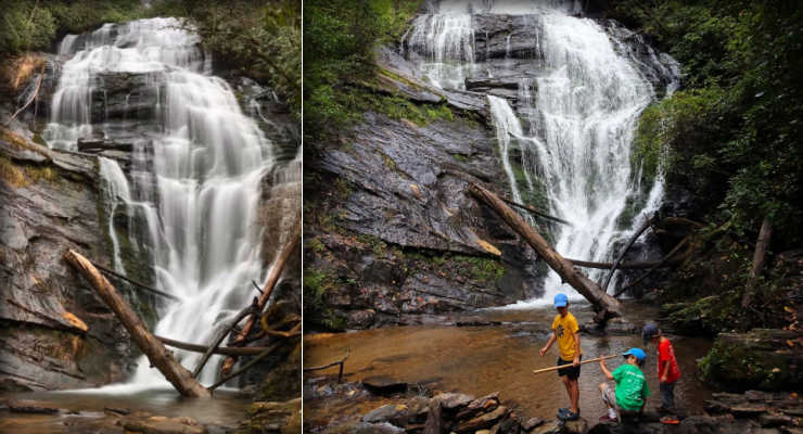
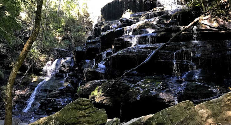
Have you heard about the Beech Bottom Falls trail? KAG contributor Liene explores another one of the Upstate’s waterfalls, Beech Bottom Falls, also known as Pinnacle Falls! An adventurous trail will take your family across a footbridge straight out of a fairytale, to a viewing platform overlooking a beautiful waterfall. This is a perfect hike to combine with a day trip up to Sassafras Mountain, the highest point in South Carolina!
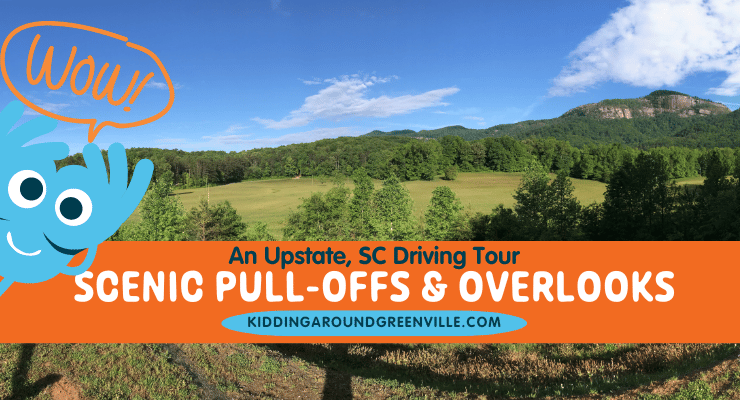
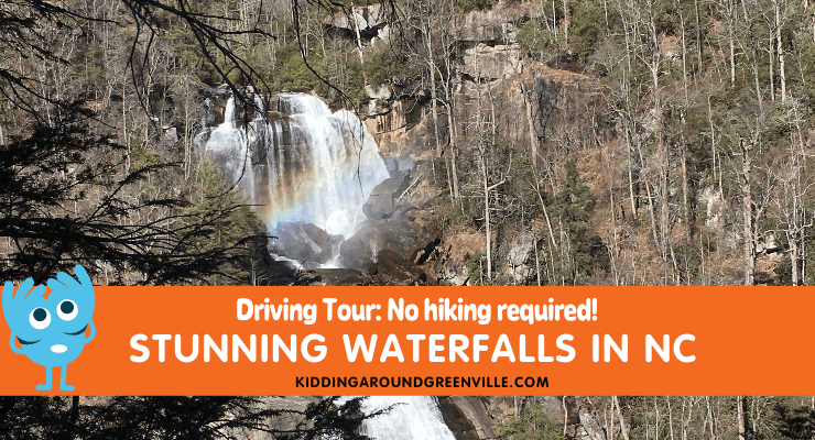
Want to see the great outdoors without actually hiking? Kidding Around’s Kristina loves hunting out great waterfalls. She’s created this amazing driving tour packed full of stops where you can see waterfalls without hiking. It’s a perfect day trip activity. She even included a map with all the stops. So fire up that GPS or pop open your favorite map app and get going!
Looking for more waterfalls? 💧Love waterfalls? Here’s our list of Waterfalls in the Southeast with great hiking in South Carolina, Georgia, North Carolina, and Tennesse. 💧Also, if you happen to just love waterfalls like we do and are looking for opportunities to keep them clean and pristine, look into volunteering at any of these outdoor places.
There are few places I’d rather be on the weekends than hiking with my kids to some spectacular waterfall. I’ve done a lot of them and plan lots more. But sometimes hiking a few, or more, miles just isn’t happening. But waterfalls? Yes, I still want to see them!
So if you have the grandparents on board and can’t hike or if there is no way you are listening to kids whine for two hours in the woods or for whatever reason you aren’t hiking, we’ve put together an epic (yes, this is epic) waterfall tour in North Carolina for the ultimate day trip that will kill it on your Instagram feed.
If you need more fun in Western NC, see our big Guide to WNC!
North Carolina Waterfall Driving Tour Map
Just beyond the South Carolina/North Carolina border lies the “Land of the Waterfalls” – it’s true, there is an actual sign that says this – so this is where our epic tour takes you. And because we love our readers and want to make things super easy, we also put together a map of the tour!
I suggest you pack a lot of snacks, drinks, lunch, and some car entertainment since you will have to spend time on the road, even though the drive through the mountains is gorgeous.
You can do this tour starting at either the first or the last waterfall as it takes about the same amount of time as well.
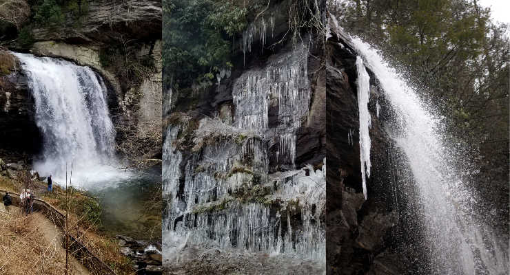
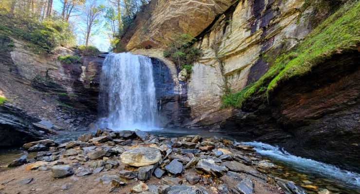
Looking Glass Falls
This waterfall is huge and gorgeous. It’s been on my list since I saw an incredible shot of the falls frozen during the winter. I was really hoping to catch the same photo when I went but it wasn’t cold enough. However, ice did cover the stairs at the very bottom of the falls and the surrounding trees, branches and rocks. It was awesome.
You can literally see the falls from the car but park it anyways, get out and if you have people who are willing and able to walk down the stairs, you can get a close-up view. But if not, you will still get to see the falls in all their glory.
Directions
From Greenville, take 276 W to 25 N and take Exit 5 to 25 N. Take Crab Creek Road to 64 W in Brevard and then take 276 N into Pisgah National Forest. The falls will be on your right.
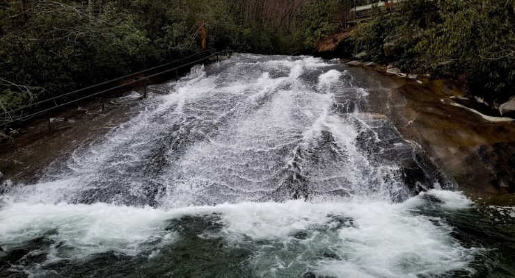
Sliding Rock
Right down the street from Looking Glass Falls in the Pisgah National Forest is the popular summer destination of Sliding Rock. During the winter, there is no one there and you don’t have to pay to enter (during the summer season, it is $5/person).
You can see Sliding Rock from the top where the bathrooms are located and it’s a short walk down the stairs to the platform that overlooks the gigantic natural waterslide.
The pool is about eight feet deep and during the summer there are lifeguards to keep everyone safe. It’s a sight to see though!
Directions
From Looking Glass Falls, keep going on 276 into the forest and Sliding Rock is about four minutes away on the left.
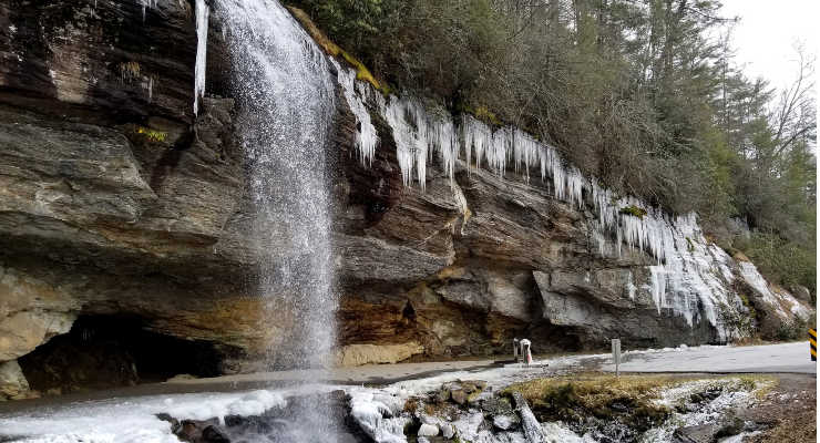
Bridal Veil Falls
It’s about an hour and 20 minutes from Sliding Rock to Bridal Veil Falls in between Cashiers and Highlands but the drive along 64 is gorgeous. And you can go through Brevard if you like and grab lunch (I’d suggest Square Root for higher end cuisine or grab some delicious pastries and bread to make sandwiches at the Bracken Mountain Bakery) to space out the trip and fuel up. We also love stopping at the original O.P. Taylors toy store in downtown Brevard.
Bridal Veil Falls is literally on the side of the road. You could even stay in your car and see this beautiful 60-foot cascading waterfall but really, you should get out because it’s so pretty, especially in the winter when it freezes over occasionally and icicles drop down and make the whole scene ethereal.
You can walk behind this waterfall too, which makes it even cooler. You used to be able to drive behind it but you aren’t allowed anymore.
Directions
Take 276 back to Brevard and make a right on 64 W. Take that all the way through Cashiers and the falls will be about 11.5 from Cashiers on your right.
Dry Falls
A two-minute drive down the road will bring you to Dry Falls on the left. Park in the lot and either use the handicap accessible ramp to go to the overlook or in the warmer months head down to the falls and walk behind them and take photos to make everyone you know jealous.
These falls are huge and loud and incredible. If you are able to walk behind the falls, stay on the path and behind the railing and don’t walk out on the rocks. Waterfalls are dangerous and you don’t want to become a statistic.
If you’re hungry on your way out from Dry Falls, stop at Slabtown Pizza in Cashiers for delicious pizza.
Directions
Stay on 64 W for .8 miles and the falls and parking will be on your left.
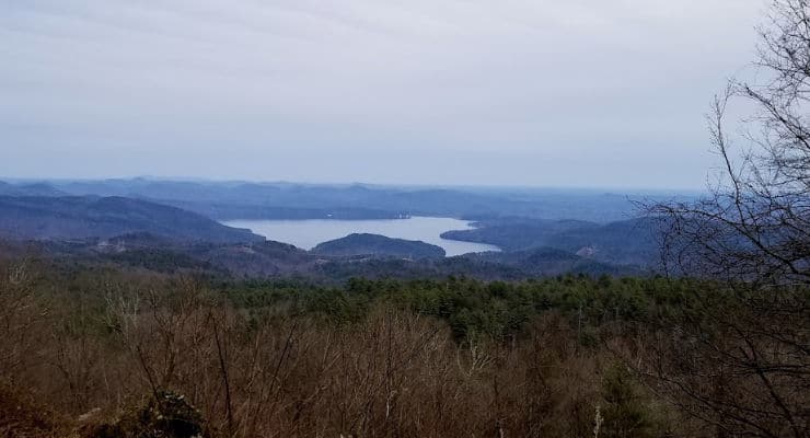
Bonus: Lake Jocassee Overlook
I wasn’t expecting this driving to the last waterfall stop so it was a bonus for me. About three miles or so from Whitewater Falls is this overlook that will take your breath away.
You can see all of Lake Jocassee and marvel at the beauty of the gorge. Stop, take photos, have a snack. It’s worth it.
Directions
It’s on Route 130 from Cashiers to Whitewater Falls. You can’t miss it.
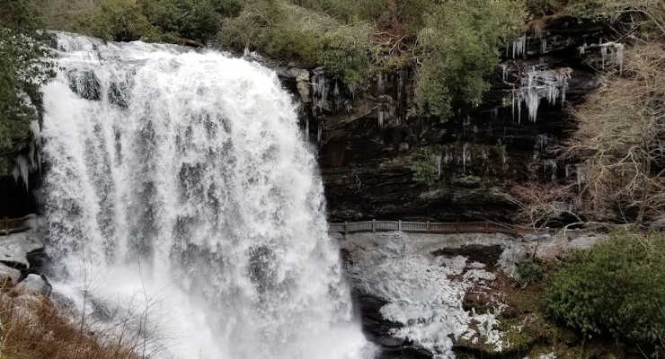
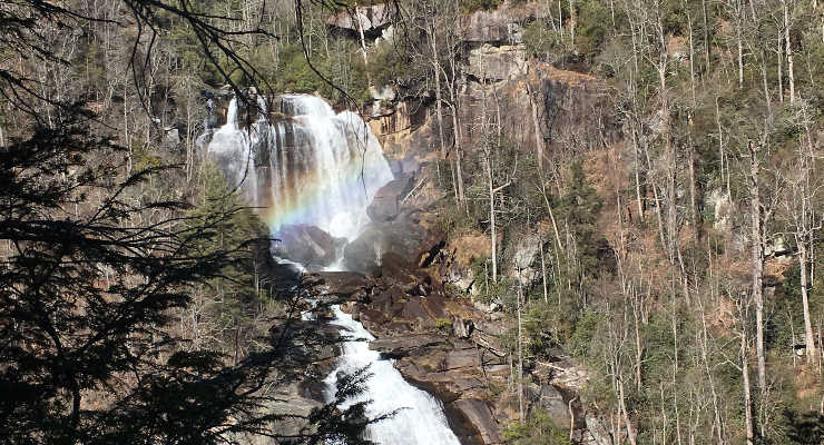
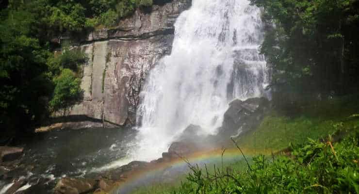
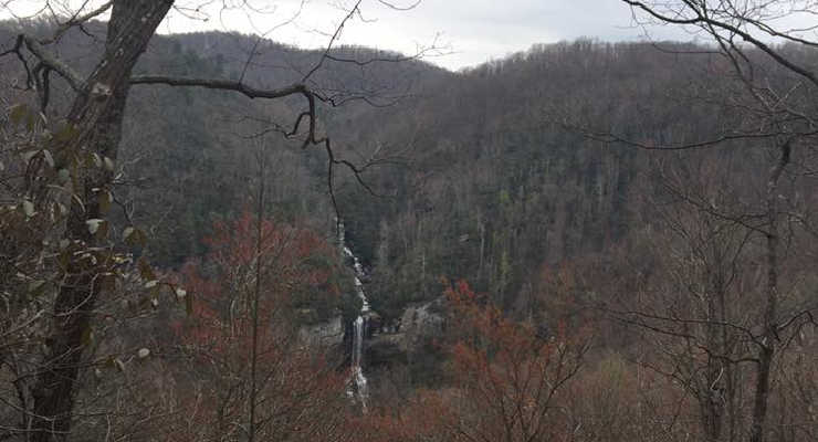
Whitewater Falls
The last waterfall on our list is the biggest waterfall east of the Rocky Mountains, standing at a whooping 411 feet tall, cascading down the mountainside in all it’s beautiful glory.
Whitewater Falls is just under 40 minutes from Dry Falls and is totally worth the trip. Even though I promised no hiking, don’t be mad about this quarter-mile paved trail to the falls. The sign says the falls are a half-mile from the parking lot but they mean round trip. The trail is very short and the view is amazing.
If you are ambitious and want to get out energy from the car ride, head to the stairs on the right, which will take you down to the viewing platform where you can see all of Whitewater Falls. It’s a nice little workout getting back up those 154 stairs.
Directions
From Dry Falls, go east on 64, hang a right at the center of Cashiers onto 107 South, and then make a left onto 130 North and follow signs to the falls. It’s about 25 miles total.
Looking for waterfalls in South Carolina, North Carolina, Georgia, and Tennessee? Enjoy a waterfall hike with beautiful views as a reward, then relax by the sound of rushing water with a snack. Some waterfalls even have pools suitable for wading where you can cool off after a hot summer hike. We’ve put together a list of our favorite waterfall hikes in the southeast! Most of these hikes are great for families to do together, there are even a few that don’t require anything more than a short walk to view the falls.
We split up our list of great waterfall hikes by state. Use the links below to navigate our list!
Remember, exploring waterfalls can be dangerous with slippery rocks and drop-offs. Obey all signage and always use caution.
Find the Best Waterfalls For You
No hiking waterfalls
If you love waterfalls but need to avoid hikes, try our Waterfall Driving Tour! Many of the waterfalls can be viewed from the road, or require just a short walk down paved paths, perfect for families with small children and those with mobility concerns.
Waterfalls for families with babies and toddlers
Not all waterfall hikes require miles of strenuous hiking. Our guide to the Best Hikes for Toddlers and Young Children includes many beautiful waterfalls like Wildcat Wayside, Pearson’s Falls, and Yellow Branch Falls.
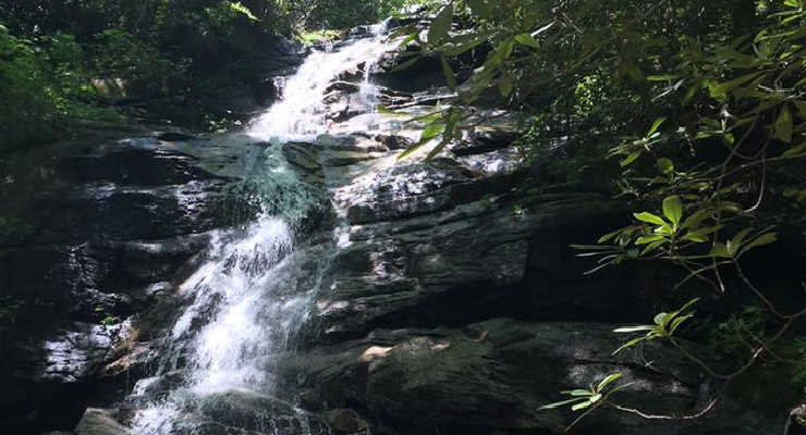
Here’s our list of waterfalls and waterfall hikes in South Carolina. These are gorgeous spots that our families have loved to visit again and again. Pack a picnic, and throw in a beach towel. You’re not going to want to miss any of these!
Greenville, SC Waterfalls: Discover Magical Waterfalls near Greenville SC in our guide. Whether you want to take in a waterfall while enjoying a long hike or a waterfall that you can view with very little effort, local mom Kristina has all the details!
Waterfalls at Laurel Fork Heritage Preserve
Sunset, SC
The beautiful Laurel Fork Heritage preserve is worth the drive, even if you never intend on getting out of the car, although I encourage you to. There are several hiking trails and roadside waterfalls. Depending on recent rainfall, one might be sufficient to splash around in. The over 1,300-acre preserve is an easy place to get away from everything.
Beech Bottom Falls
F Van Clayton Memorial Hwy Sunset, SC
Not far from Laurel Fork H.P. and on the way to Sassafras Mountain, you’ll see the Beech Bottom Falls trailhead parking lot for the falls. This is an easy two-mile round-trip hike to an observation deck that overlooks the falls.
Twin Falls
Water Falls Rd Sunset, SC
This is an easy hike that is only a ¼ of a mile. There are places to splash in the water, but please use caution. While these falls are beautiful, they are also dangerous. Never, ever sit or stand on top of a waterfall.
Twin Falls in Pickens, SC
Spoonauger Falls
Burrells Ford Rd Mountain Rest, SC
Spoonauger Falls is a 50-foot waterfall reached by just a short trail from Burrells Ford Road located in the Ellicott Rock Wilderness. At just 0.3 miles to reach the base of the waterfall, it’s a perfect excursion for a family with small children.
Spoonauger Falls/ Photo Credit: Liene Kukainis
King Creek Falls
Long Creek South Carolina
King Creek Falls can be accessed from the Burrells Ford campground, from the parking area on Burrells Ford Road, and also while through-hiking the Foothills Trail. If you’re staying in the campground, the hike can be as short as a one-mile round-trip. If you’re coming in from the parking area, the hike is closer to 1.5-2 miles, depending on which trail you take. But since the trail climbs steadily up towards the waterfall, even that ½ mile can be hard for shorter legs when it’s a hot summer day – which is why the pool at the base of King Creek Falls is a perfect reward.
King Creek Falls / Photo Credit: Liene Kukainis
Rainbow Falls – Jones Gap State Park
303 Jones Gap Road Marietta, SC
The trail to Rainbow Falls is around 2.5 miles one-way, mostly up in a staircase manner. Plan to spend plenty of time wading at the base of the falls with a picnic in tow. Hiking alone may take 4-5 hours depending on the ages and abilities of your kids, plus picnicking time.
While this is a strenuous hike, there are no major dangers on the trail itself (other than the falls, of course) it is simply sweat-inducing, and the falls are worth it!
Rainbow Falls at Jones Gap
Jones Gap Falls – Jones Gap State Park
303 Jones Gap Road Marietta, SC
Jones Gap Falls is a round-trip 2.6-mile hike along a river that ends at a fan waterfall splashing over a 50-foot drop, spilling over a staircase of granite ledges. Pack a picnic and plan to spend a few hours on this lovely trail with your kiddos. The trail is so beautiful that if your kids couldn’t stick it out to the falls, nothing would be lost alongside that gorgeous river.
Jones Gap Falls
Issaqueena Falls
Walhalla, SC
Issaqueena Falls is a short hike from Stumphouse Tunnel through a covered bridge to an observation deck for viewing a lower area of the falls.
There is a path that continued past the observation deck, but parents should be aware that it isn’t a maintained trail and poses safety concerns. There have been several deaths and many accidents at this waterfall so be careful and aware of your surroundings even on the marked trails.
Horseshoe Falls – Musgrove Mill State Historic Site
Horseshoe Falls Rd Enoree, SC
Horseshoe Falls is located at the start of the Battlefield Trail at Musgrove Mill State Historic Site. It is a very short walk from the parking lot and is accessible by wheelchair.
Hikers of the battlefield trail will continue on past the falls, where the trail is no longer paved. The battlefield trail is a 1.3-mile loop, with frequent signage that describes the backcountry’s role in the Revolutionary War.
Horseshoe Falls at Musgrove Mill State Historic Site
Blue Wall Preserve
Landrum, SC
Blue Wall Preserve is a 575-acre preserve owned by The Nature Conservancy and has stunning views of the Blue Ridge mountains. The trails are well-defined, and at the back end of the 3.4-mile loop, you will be rewarded with a waterfall.
The waterfall at Blue Wall Preserve
Raven Cliff Falls – Caesars Head State Park
8155 Geer Hwy Cleveland, SC
Getting to Raven Cliff Falls at Caesars Head State Park is a long and arduous trek along a few different trails, but if you have the kids with you and prefer something more manageable, you still have the option to see the falls from afar. Start at the Raven Cliff Falls parking lot and take the Raven Cliff Falls trail about 2 miles out to an overlook where you can view the falls. You cannot hike to the bottom of Raven Cliff Falls.
Raven Cliff Falls at Caesars Head
Carrick Creek Falls – Table Rock State Park
158 Ellison Lane Pickens, SC
The Carrick Creek Trail at Table Rock State Park begins at the Nature Center. It starts out paved and immediately opens up to the beautiful Carrick Creek Falls where your kiddos can wade around in a cool, shallow lagoon fed by a cascading waterfall.
Beyond that, the pavement ends and the trail becomes a bit more moderate as it follows the creek for a while and then loops around back to the falls for a grand total of two miles. You and your kids will enjoy traveling alongside the creek as the rushing water drops over boulders and slides along ledges, creating an amazing backdrop for a hike.
The waterfall at Carrick Creek
Riley Moore Falls
Riley Moore Falls Trail Westminster, SC
Riley Moore Falls is a waterfall at the end of a short trail with a small beach. It’s a beautiful place but be aware some people are careless with their trash at this location, unfortunately. The trail is about two miles and starts at the end of the forestry road.
Riley Moore Falls
Wildcat Wayside
US 276/SC 11 Cleveland, SC
This waterfall, swimming hole, and trail are located right off SC 11 in Cleveland. There are stone steps leading up to the trails – the Wildcat Wayside loop is an easy mile.
Heading north on Route 11, the trail and pull-off parking area are located on the right side of the road. There is a brown wooden sign that says Wildcat Wayside, but it is easy to miss. It’s about 5 miles north of the 276/11 intersection.
Wildcat Wayside
Yellow Branch Falls
Walhalla, SC
A moderate three-mile round trip hike near Walhalla with a beautiful waterfall payoff. Parking is trailside on the road. This one is fairly popular so try to get there early in the day to get a parking spot.
Yellow Branch Falls
Station Cove Falls
State Rd S-37-95 Walhalla, SC
Station Cove is an easy trail less than two miles round trip that has a huge, beautiful waterfall. It’s located at Oconee Station State Historic Site and is an easy trail perfect for little kids.
Station Cove Falls
North Carolina Waterfall Hikes: Waterfalls in NC
Waterfalls in North Carolina are stunning. Wonderful family day trips have been made by these waterfalls, and we know you’ll love them, too!
Kidding Around’s Kristina visited Sapphire Valley with her family and discovered why it is nicknamed, “Land of the Waterfalls.” She has all the details on the numerous waterfall hikes in this beautiful area in her article Sapphire Valley.
Sliding Rock
Waterfalls of DuPont State Recreational Forest
Staton Rd Cedar Mountain, NC
With its 900 miles of hiking trails, six major waterfalls, and over 10,000 acres of forest, DuPont State Forest is a showcase of some of the most fabulous scenery in western NC, just an hour from Greenville! KAG Contributor Liene tells us all about the best waterfalls hikes in Dupont State Forest.
Waterfalls at Triple Falls, Dupont State Forest
Catawba Falls [Reopens May 31, 2024]
3074 Catawba River Rd Old Fort, NC
This trail east of Asheville is a fantastic trail for families because it’s not long and ends at a stunning waterfall. Total mileage is around 2.5 miles and it’s a fairly easy trail.
Pearson’s Falls
2748 Pearson’s Falls Rd Saluda, NC
Located in Saluda, NC this trail to Pearson’s Falls is a moderate, .75 mile hike through a botanical preserve. Most of the trail is made up of a stone stairway going up to the falls. The falls and the pond at the base of the falls are not accessible to the public, but there are multiple wading pools among the rocks at the top of the trail that are perfect for cooling off little feet on hot days.
Waterfall at Pearsons Falls
Little Bradley Falls
Holbert Cove Road Saluda, NC
To reach Little Bradley Falls, hikers can park at a gravel pull-off on Holbert Cove Road, which is about three miles from exit 59 on I-26. There are no signs, but the hike to Little Bradley starts on the opposite side of the road from the main parking area, across the bridge on the east side of Cove Creek.
The trail is a 2.4 mile out and back moderate hike across boulders and through streams. It ends at the 35-foot, triple-tiered waterfall that feeds into a large pool at the bottom, perfect for wading and cooling off on a hot summer day.
Little Bradley Falls
Moore Cove Falls
Brevard, NC
The trailhead to the Moore Cove Falls Trail is between Looking Glass Falls and Sliding Rock in the Pisgah Forest on 276. If you’re coming from Brevard, the trailhead will be on your right.
To get to the falls, just cross the bridge and head up the stairs to the right. The trail is well-marked and has a few creek crossings and bridges. It is about 1.2 miles round trip and is great for families with smaller kids since you don’t need to work hard to see a beautiful sight!
Moore Cove Falls
Hickory Nut Falls
431 Main Street Chimney Rock, NC
The trail to Hickory Nut Falls at Chimney Rock State Park is a 1.4-mile round trip moderate hike. The waterfall at the end is an epic 404-foot-high beauty that was featured in the film, “The Last of the Mohicans.”
Hickory Nut Falls at Chimney Rock
Rainbow Falls and Turtleback Falls at Gorges State Park
976 Grassy Ridge Road Sapphire, NC
Rainbow Falls at Gorges State Park is one of my favorite waterfalls and trails in our area. The waterfall is enormous, and you can get a really good view from the overlook on the trail or you can take a smaller trail down to the bottom of the falls (just be careful).
But if you keep going another quarter-mile from those falls, you’ll come to more waterfalls. Turtleback Falls isn’t as stunning but it’s really fun. It’s a great place to cool off and go for a swim before heading back to the trailhead.
The trail is about four miles round trip and of moderate difficulty. The hike back is harder and more uphill than the hike to the waterfalls.
Rainbow Falls
Whitewater Falls
NC 281 Cashiers, NC
Cascading more than 800 feet tall, Whitewater Falls is the tallest waterfall in the Eastern United States – and it’s easily accessible just over the border into North Carolina and close to Gorges State Park.
The trail is a paved quarter-mile walk that gets you to the overlook of the falls. You can go down a stairway to get a closer view.
Whitewater Falls
Looking Glass Falls
US-276 Brevard, NC
Right off 276 in Pisgah Forest in North Carolina, you can see this stunning waterfall from the road. It is beautiful and loud and amazing. If it’s really cold, Looking Glass Falls has iced over in the past, making it a winter wonderland.
It’s very close to Brevard, about 15 minutes away in the forest. Park on the shoulder of the road and you can walk down to the bottom on the path and stairs.
Looking Glass Falls
Mingo Falls
Eastern Cherokee Reservation Cherokee, NC
Located in Cherokee, NC, the hike to Mingo Falls involves climbing a lot of stairs. I think it’s worth it because the waterfall is beautiful. It’s a great stop if you’re near the Great Smoky Mountains.
High Falls
358-1486 State Rd 1158 Glenville, NC
Also in North Carolina near Cashiers is High Falls. The waterfall is located below the dam of Lake Glenville and the dam releases water a few times a year which kayakers really love. The trail is of moderate difficulty and under four miles round trip.
Tennessee Waterfall Hikes
Mouse Creek Falls
Hartford, TN
Mouse Creek Falls can be accessed via Big Creek Trail, a 4-mile moderate hike along a river. While you’re in the area, check out the gorgeous Midnight Hole Lagoon!
Cataract Falls
Sevier County, TN
In the Great Smokey Mountains National Park, there is a one-mile round trip easy nature trail you can take along a creek that goes to the small but pretty Cataract Falls. It’s perfect for families with small kids.
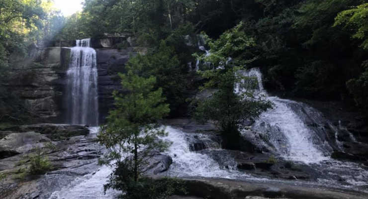
Georgia Waterfall Hikes: Waterfalls in GA
The mountains of Northern Georgia are full of beautiful waterfalls. Below are some of our family favorites. These are waterfalls in Georiga that you just shouldn’t miss.
Anna Ruby Falls
Helen, GA
Get all the information about a trip to Anna Ruby Falls in our review!
Anna Ruby Falls is actually a spectacular double waterfall, as two waterfalls combine to form Smith Creek. The down-and-back trail to the falls is paved, with a moderate incline at times, as it follows the boulder-lined creek to the falls. It’s a very pretty trail, and though short, it’s worth a trip in and of itself. There are multiple overlooks to enjoy the falls for a while before returning back down the trail.
The trail begins at the Anna Ruby Falls visitor center where you will find restrooms and a gift shop, plus scenic picnic areas along the creek.
Don’t miss the Alpine town of Helen, GA while you are in the area. If you’re looking for more hiking, don’t miss nearby Unicoi State Park. The hike around the lake is pretty and family-friendly.
Anna Ruby Falls
Trahlyta Falls
Blairsville, GA
At Vogel State Park, you’ll find a scenic trail around a small lake: Trahlyta Lake. You’ll start at the visitor’s center and as you walk around the lake you’ll come to a spur at the lake’s dam. Take the short spur trail down and you’ll quickly come to Trahlyta Falls. After viewing the falls you’ll walk back up the spur trail to finish the trail around the lake. The trail around the lake is mainly gravel and flat, while the spur trail to the falls is a bit steep on the way back up.
There are lots of other fun things to do in Blairsville, GA, too!
Trahlyta Falls
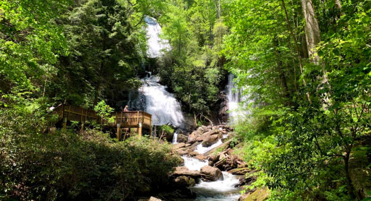
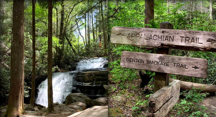
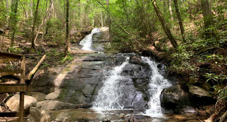
Long Creek Falls
Blue Ridge, GA
The trail to Long Creek Falls is an easy 1.9-mile hike. Want to say you’ve walked some of the Appalachian Trail with your family? The Long Creek Falls Trail combines with the AT and the Benton Mackaye Trail for most of the hike until it veers off to the falls. The signage to the falls is very clear, so you won’t end up hiking all the way to Maine.
The falls itself is beautiful with a nice area to relax, enjoy a snack on a rock, or even string up a hammock and enjoy the afternoon.
Note that the trailhead for Long Creek Falls is off of a gravel road. You’ll need to drive on gravel Forest Service Road 40 for about 5 miles once you turn off the main road, Doublehead Gap Road. We did this drive in a minivan. We likely would not have been able to make the drive had there been recent rain and the road was wet. 4×4 vehicles are generally recommended on the forest service roads, although we did see many 2-wheel drive cars using the service road. Go slow and watch for potholes and larger rocks in the road.
Long Creek Falls
Fall Branch Falls
Blue Ridge, GA
The trail to Fall Branch Falls is only 0.9 miles. It’s a down-and-back trail that is very heavily trafficked. It’s an easy hike for families with children, and the drive is nearly all on paved roads, with just the last tenth of a mile or so on gravel. Fall Branch Falls has several cascades and then a 30-foot drop into the pool. There is an observation deck right beside the pool. These things make the Fall Branch Falls trail pretty popular. The parking area is also a very short walk away from a pretty mountain creek you should check out before or after your hike to the falls.
The trail to Fall Branch Falls sees a lot of traffic. Please stay on the trail and notice the places where hikers have cut off parts of the switchback by going off-trail. These areas show significant erosion. Check out our article on Leave No Trace to learn about caring for trails and nature.